Catalog Archive
Auction 203, Lot 470
"Cote d'Azur France - Nice Cannes Menton and the Coast Roads"
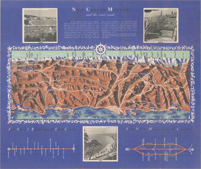
Subject: Southeastern France
Period: 1950 (circa)
Publication:
Color: Printed Color
Size:
20.5 x 17.3 inches
52.1 x 43.9 cm
Download High Resolution Image
(or just click on image to launch the Zoom viewer)
(or just click on image to launch the Zoom viewer)