Subject: Antwerp, Belgium
Period: 1630 (circa)
Publication:
Color: Hand Color
Size:
21.7 x 17.9 inches
55.1 x 45.5 cm
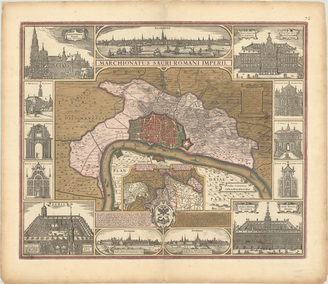
This is a superb map of the Marquisate of Antwerp with the city fortification delineated and the surrounding countryside and suburbs pictorially shown. The central plan is inset with a regional map of Brabant and surrounded with three city views and ten building vignettes. Along the top is a view of the city from the river that is flanked by elevations of the Cathedral and the Senate House. Two smaller views of the city at bottom are flanked by elevations of the Stock Exchange and the Hanseatic League Warehouse. Six smaller vignettes at sides detail churches and city gates.
References: Campbell (MCC-46) #8, plt. IV.
Condition: A
A sharp impression with full contemporary color and a minor abrasion near the center of the image. There are short centerfold separations at top and bottom that have been closed on verso with old paper, light toning along the edges of the sheet, and remnants of hinge tape on verso.