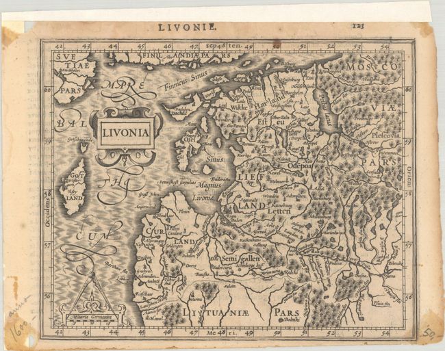
Subject: Baltic, Latvia & Estonia
Period: 1609 (circa)
Publication: Atlas Minor
Color: Black & White
Size:
7.5 x 6 inches
19.1 x 15.2 cm
This beautiful miniature map covers present-day Estonia, Latvia, and part of Lithuania. It is fully engraved to illustrate the forests, cities, and villages and is embellished with a strapwork title cartouche and scale of miles. French text on verso, published between 1609-14.
References: Van der Krogt (Vol. III) #1710:351.
Condition: B+
On watermarked paper with a small spot in the border at top and old tape stains in the corners of the sheet that enter the map border at bottom right. There is marginal chipping and a couple of short tears that have been partially repaired with hinge tape along the top edge on recto and along the left edge on verso.