Subject: Lima, Peru
Period: 1756-69 (circa)
Publication:
Color: Hand Color
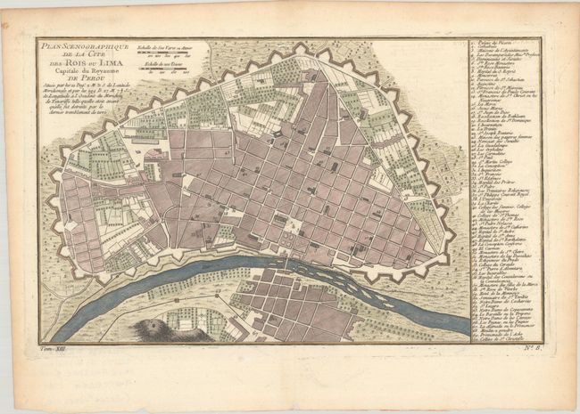
A. Plan Scenographique de la Cite des Rois ou Lima Capitale du Royaume de Perou, by Jacques Nicolas Bellin, from Prevost's Histoire Generale des Voyages ... Tome Treizieme, published 1756 (12.6 x 7.7"). This intricate copper-engraved plan shows the fortified city of Lima, the capital of Peru. The key at right locates 70 features on the map, including cathedrals, universities and colleges, monasteries, hotels, and more. Condition: A crisp impression with minor offsetting and light toning along the sheet edges.
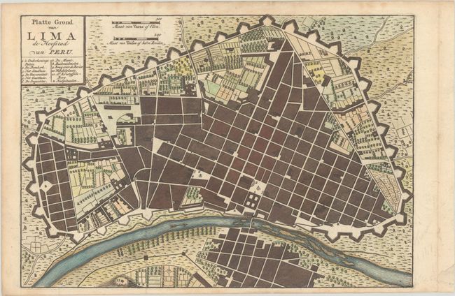
B. Platte Grond van Lima de Hoofstad van Peru, by Isaak Tirion, from Hedendaagsche Historie, of Tegenwoordigestaat van Amerika, circa 1769 (10.3 x 7.3"). This striking plan shows the fortified city of Lima in nice detail. A key below the title identifies the major buildings, including a palace, cathedral, town hall, and hospital. The city is protected on one side by a river while extensive ramparts and suburbs surround the other sides. Tirion's Hedendaagsche Historie was initially conceived as the Dutch edition of Thomas Salmon's Modern History. The work began in 1729, but the text was later expanded and the Hedendaagsche Historie was therefore not completed until 1803. Reference: Shirley (BL Atlases) G.TIR-1a #12. Condition: A sharp impression issued folding, now flat, with an archivally repaired chip in the right blank margin.
References:
Condition: A
See description above.