Subject: Northern Virginia
Period: 1915 (dated)
Publication:
Color: Printed Color
Size:
29.9 x 31.9 inches
75.9 x 81 cm
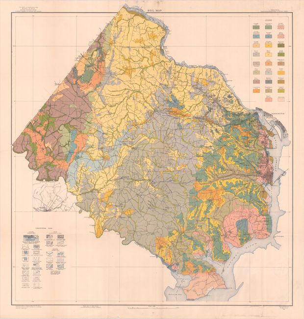
This visually striking map of Fairfax and Alexandria counties presents 26 different soil types through a combination of both color and texture. In addition to soil types, the map features many other details from the U.S. Geological Survey including roads, railroads, cities and towns, county boundaries, individual buildings, and more. The street grid pattern of Alexandria and the southern edge of Washington are depicted. Soil surveyed by William Carter Jr. and C.K. Yingling Jr. Lithographed by Hoen & Co. in Baltimore.
References:
Condition: B+
Clean and colorful with a crease at bottom right and two small tears at top and bottom right that have been repaired on verso with archival tape. Several other small tears and separations that are confined to the blank margins have also been archivally repaired. There is an old library stamp on verso.