Subject: Texas
Period: 1936 (published)
Publication: Geology of Texas, Volume II, Structural and Economic Geology
Color: Printed Color
Size:
50 x 39.9 inches
127 x 101.3 cm
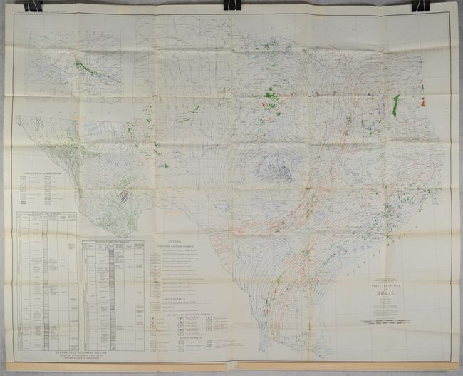
This massive geological map of the state was drawn by C.E. McCarter under the direction of E.H. Sellards, Director of the University of Texas Bureau of Economic Geology. It shows extensive detail of the geological structures utilizing both color and symbol to locate oil and gas fields, producing wells, salt domes with their oil and gas features, faults, and structure contours. In addition to the geology, the map shows good base data including counties, cities and towns, rivers, and more. The panhandle is continued in an inset on the same scale at top left, while two stratigraphic columns fill the area at bottom left. This is the first edition of Sellard’s landmark map that highlighted the Permian and East Texas Basins, which became two of the most productive oil regions in the world. Lithographed by A. Hoen & Co. in Baltimore.
References:
Condition: B+
Issued folding on a bright sheet with numerous short splits at the fold junctions.