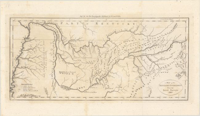
Subject: Tennessee
Period: 1810 (dated)
Publication: New Encyclopaedia
Color: Black & White
Size:
15.2 x 7 inches
38.6 x 17.8 cm
This is a very early depiction of Tennessee based on maps by Carey and Reid. The map details the topography and notes the early Kentucky Road as it winds down to the Holsten River, where Ross's Ironworks are located. The map also traces the Mississippi, Tennessee, and Cumberland rivers, and extends as far south as the northern portion of what would become Alabama (showing Muscle Shoals at the bend of the Tennessee River). The early settlements of Nashville, Knoxville and Clerksville are shown, and Fort Massac is located on the Ohio River. Originally appeared in Payne's New and Complete Universal Geography, also published by Low. Although the date in the cartouche has been updated to 1810 on this later edition, the cartography appears to be identical to the 1799 map. This example also comes with a related page of text from Low's New Encyclopaedia.
References:
Condition: B+
Issued folding with light toning and staining and an archivally repaired edge tear that enters less than 0.5" into map image at right.