Subject: South Carolina
Period: 1822 (published)
Publication: A Geography for Schools...
Color: Hand Color
Size:
7.1 x 5.6 inches
18 x 14.2 cm
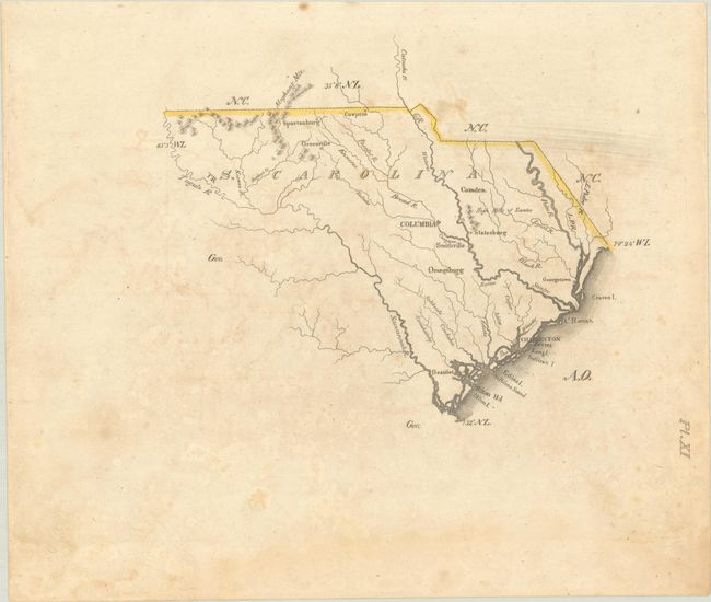
This small map was issued in Luke Drury's scarce A Geography for Schools, upon a Plan Entirely New, Consisting of an Analytical Arrangement of All the Great Features of Nature, Particularly Adapted to an Atlas of Forty Luminous and Concise Maps. It shows an unsettled border in the west which lacks outline coloring or boundary line definition. The inferred border appears to be the Tugulo [now Tuguloo] River. While the colonial boundary of South Carolina was set as the Savannah River, there was disagreement as to whether the Tugulo or the Keowee River to the east was part of the Savannah River for defining the boundary. The map presents basic details including the river systems, some small mountains in the northwest and the "High Hills of Santee" above Statesburg, and a number of cities and towns including Charleston, Beaufort, Columbia, Spartanburg, and more. According to Tooley's Dictionary of Mapmakers, this was Drury's only publication.
References: Phillips (Atlases) #279.
Condition: B
Contemporary outline color with light offsetting, minor foxing, and a faint dampstain at bottom.