Subject: Pittsburgh, Pennsylvania
Period: 1939 (dated)
Publication:
Color: Printed Color
Size:
29.8 x 22 inches
75.7 x 55.9 cm
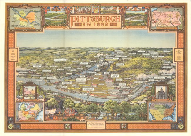
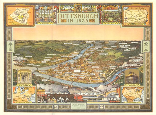
This gorgeous pair of bird's-eye pictorial maps was created by Ezra Stiles and published to celebrate the 50th anniversary of the Union Trust Company. The pair reflects the tremendous growth of the city that saw population rise from approximately 238,000 in 1890 to 671,000 in 1940. Each is taken from the same perspective looking north. The 1889 view presents limited development with illustrations of Fort Pitt, U.S. Treasury & Post Office, Market Square, and St. Paul's Cathedral. The 1939 view shows a well-developed downtown area complete with high-rise buildings including the Gulf Building, Bell Telephone Company, Koppers Building, Chamber of Commerce and more. Each is surrounded by a decorative border with 4 inset maps and illustrations celebrating the city's development.
These large bird's-eye views should not be confused with the more common smaller format version.
References: Rumsey #8168.
Condition: A
Very clean and colorful examples, issued folding. The 1889 map has one short split at a fold junction.