Subject: Oklahoma
Period: 1903-04 (dated)
Publication: Annual Report Commission to the Five Civilized Tribes
Color: Printed Color
The years after the Civil War had seen many other tribes and emigrants move into lands of the Indian Territory. In 1893 the Commission to the Five Civilized Tribes was created to sort out and divide the land between tribes and Freedmen, who were the African-American descendants of slaves freed after the Civil War. This commission became known as the Dawes Commission, after Senator Henry L. Dawes, who was largely responsible for the legislation. Their main task was to make an equitable division of nearly twenty million acres of land among more that 100,000 Indians. In 1895, the USGS began to conduct surveys of all lands in Indian Territory into townships, ranges and sections. These maps were used by the Dawes Commission to assist the citizens on the tribal rolls to select their individual plats of land. These maps are part of the documentation published annually by the commission.
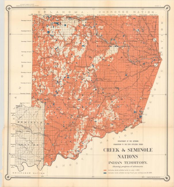
A. Creek & Seminole Nations Indian Territory, from Eleventh Annual Report Commission to the Five Civilized Tribes, dated 1904 (24.8 x 26.3"). This map uses color block to show the progress in lands allotted to the Creek Nation. Very detailed it also shows watershed, townships, rail roads, wagon roads, towns and villages, missions and court houses. Surrounded by Oklahoma on the west, Choctaw Nation on the south and the Cherokee Nation on the east. The few high areas are indicated by hachure. Complied and drawn by C.H. Dana.
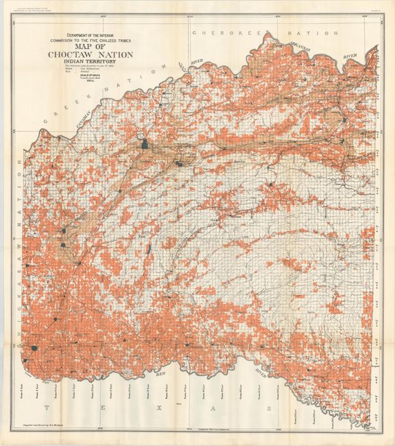
B. Map of Choctaw Nation Indian Territory, from Eleventh Annual Report Commission to the Five Civilized Tribes, dated 1904 (32.6 x 36.8"). This carefully engraved and colored map shows the lands allotted to the Choctaw Nation as of July 1904, as well as segregated coal and asphalt lands. Also provides a detailed view of the rivers and creeks, railroads and towns. Complied and drawn by R.L. McAlpine.
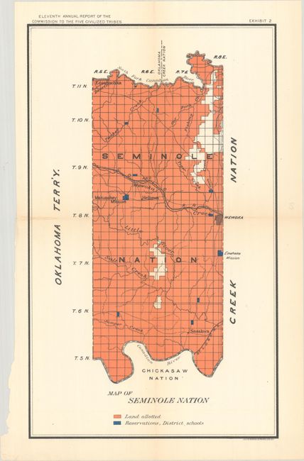
C. Map of Seminole Nation, from Eleventh Annual Report Commission to the Five Civilized Tribes, (9.3 x 15.3"). This map shows the lands allotted to the Seminole Nation, as well as the locations of reservations and schools.
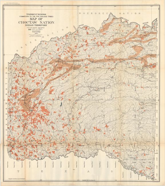
D. Map of Choctaw Nation Indian Territory, from Tenth Annual Report of the Commission to the Five Civilized Tribes, dated 1903 (32.8 x 37.0"). This map illustrates the changes in allotted lands to the Choctaw Nation between April 15 and June 30, 1903. Segregated coal and asphalt lands are shown as well. Complied and drawn by R.L. McAlpine.
References:
Condition: B+
All issued folding, mostly clean and bright with occasional minor toning. There are short fold separations, with longer fold separations closed on verso with archival tape.