Subject: Oklahoma
Period: 1874-82 (circa)
Publication:
Color:
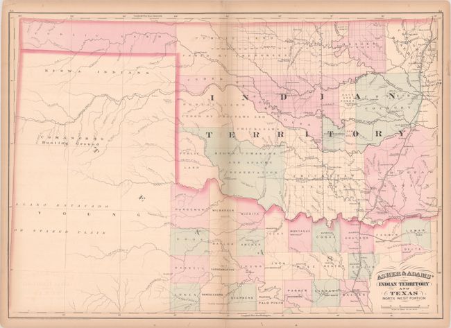
A. Asher & Adams' Indian Territory and Texas North West Portion, by Asher & Adams, dated 1874, hand color (23.1 x 16.3"). This map shows lands ceded to numerous Indian Tribes and was intended as a railroad map of Indian Territory. The Missouri-Kansas-Texas Railroad runs north-south along the eastern border of Indian Territory, and was the first railroad to enter Texas from the north, reaching Dallas by 1886. The proposed route for the Texas Pacific Railroad is also shown, which was intended to extend between Marshall, TX and San Diego, CA, but instead was connected with the Southern Pacific Railroad at Sierra Blanca, Texas in 1881. The map appeared in both Asher & Adams' New Commercial, Topographical, and Statistical Atlas... (1874) and Asher & Adams' New Columbian Rail Road Atlas and Pictorial Album of American Industry (1875). Condition: Contemporary color with light toning that is mostly confined to the centerfold and sheet's edges and short centerfold separations at top and bottom that have been closed on verso with archival tape. (B+)
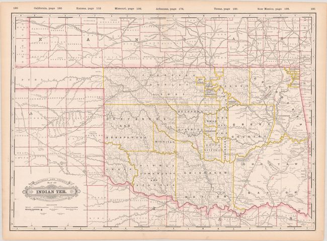
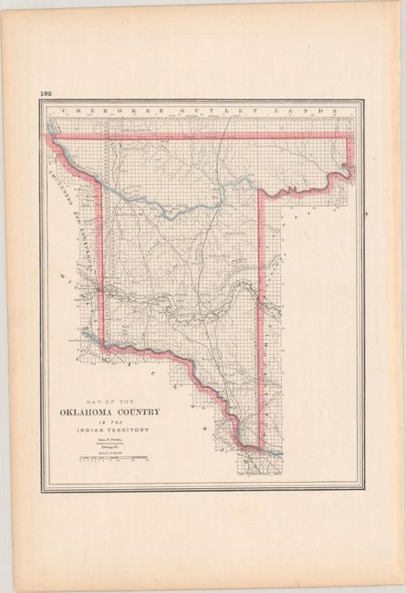
B. Railroad and County Map of Indian Ter., by George F. Cram, from Cram's Standard American Atlas Of The World, circa 1889, printed color (22.3 x 15.9"). This is the third edition of this detailed atlas map of Indian Territory. The various tribal lands are delineated and divided into grids. The Oklahoma Panhandle consists of "Public Lands." Railroads both complete and unfinished are traced. The map extends to show counties in southern Kansas and northern Texas. On verso is Map of the Oklahoma Country in the Indian Territory. Reference: Rumsey #4727.045. Condition: A bright, clean sheet with a hint of marginal toning. (A)
References:
Condition:
See description above.