Subject: North Carolina
Period: 1822 (published)
Publication: A Geography for Schools...
Color: Hand Color
Size:
9.3 x 4 inches
23.6 x 10.2 cm
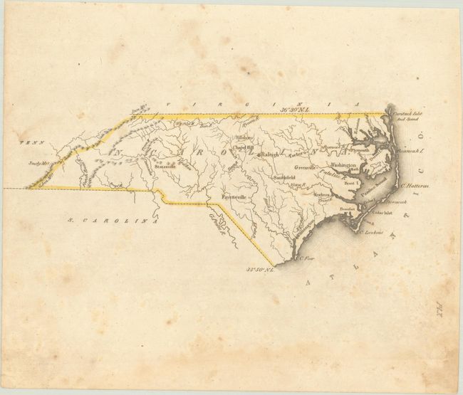
This small map was issued in Luke Drury's scarce A Geography for Schools, upon a Plan Entirely New, Consisting of an Analytical Arrangement of All the Great Features of Nature, Particularly Adapted to an Atlas of Forty Luminous and Concise Maps. It presents basic details including the river systems, the Appalachian Mountains in the western part of the state, and a number of cities and towns including Wilmington, Greenville, Raleigh, Chapel Hill, Statesville, and more. There is no mention of Charlotte though the city was incorporated in 1768. The map attributes the state's entire southern border to South Carolina, though the southwestern border was actually shared with Georgia. According to Tooley's Dictionary of Mapmakers, this was Drury's only publication.
References: Phillips (Atlases) #279.
Condition: B
Contemporary outline color with scattered foxing and a dampstain along the bottom sheet edge, away from the map image.