Subject: New York City-New Jersey Metropolitan Area
Period: 1890 (dated)
Publication: Atlas of the Metropolitan District and Adjacent Country...
Color: Printed Color
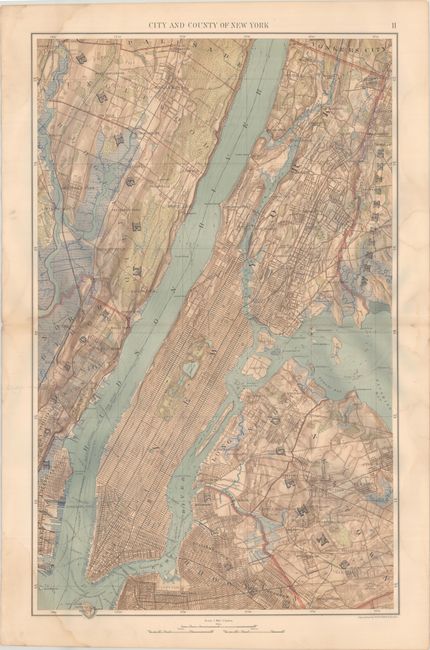
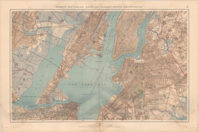
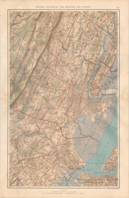
This lot includes three highly detailed maps from Atlas of the Metropolitan District and Adjacent Country... (1891), an atlas comprised of 13 maps covering New York City and its surroundings. The maps are based on surveys by J.R. Bien and C.C. Vermeule, the U.S. Coast and Geodetic Survey, and the Geological Survey of New Jersey. The first map, City and County of New York (20.0 x 31.9"), depicts Manhattan (with a prominent Central Park) and parts of Queens and Brooklyn. Across the Hudson, the map spans from Hoboken to Englewood. The second map, Brooklyn New York Bay Jersey City Hoboken Bayonne and Newark Bay (31.6 x 20.0"), extends from Newark east to Ridgewood, Queens, and from Hoboken south to Staten Island and the Narrows. The Statue of Liberty, Greenwood Cemetery, Prospect Park, the U.S. Navy Yard, Ellis Island, the Hudson River Tunnel, and much more are located. The third map, Newark - Elizabeth - The Oranges and Vicinity (20.0 x 31.8") centers on Newark, covering as far north as Passaic and as far south as Port Richmond on Staten Island. All three maps identify streets, railroads, neighborhoods, parks, depth soundings, and more, and feature terrific topographical detail. A fascinating look at New York City and vicinity near at the end of the 19th century.
References: Phillips #2150; Rumsey #2730.002; .003; & .006.
Condition: B+
All three maps have dampstaining that lightly appears in the edges of the map images. The second map has a centerfold separation in the lower margin that has been closed with archival tape on verso.