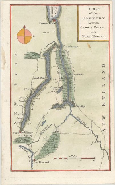
Subject: Lake George, Colonial New York
Period: 1759 (published)
Publication: Gentleman's Magazine
Color: Hand Color
Size:
4.5 x 7.4 inches
11.4 x 18.8 cm
This French and Indian War map depicts the area surrounding Lake George, along the northeastern border of New York state, extending up to Lake Champlain. Several forts are shown, including Fort Ticonderoga, along with a very good path east & west next to the drown'd lands. One of the trails is labeled Dieskau's Path referring to the route taken by French and Indian forces under the command of German Baron Ludwig August Dieskau and British and Colonial troops under Sir William Johnson that resulted in a series of skirmishes and engagements known collectively as the Battle of Lake George. This battle was the first significant win against the French forces by British Provincials. The Gentleman’s Magazine was an important contemporary source of information for the British public, illustrating the most recent engagements during the war.
References: Jolly #GENT-129.
Condition: A
Near fine with an errant spot of colorist's ink.