Catalog Archive
Auction 203, Lot 244

"Map of Greater New Orleans. Louisiana"

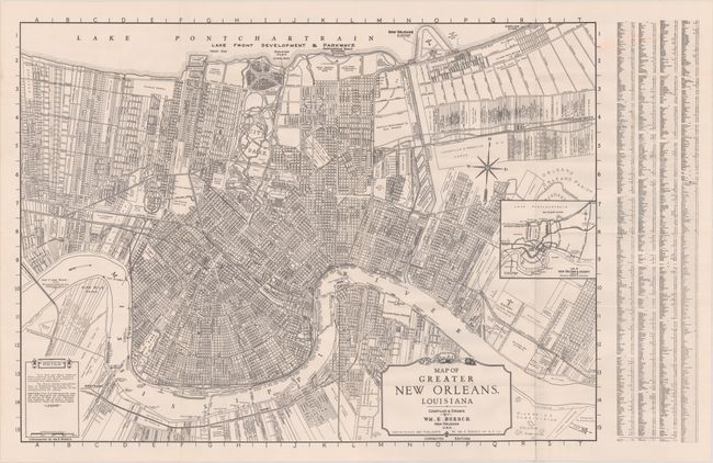
Subject: New Orleans, Louisiana

Period: 1930 (circa)

Publication:

Color: Black & White

Size:
28 x 20.5 inches
71.1 x 52.1 cm
Download High Resolution Image
(or just click on image to launch the Zoom viewer)

An especially detailed map showing the street grid pattern of the city, property ownership, and various subdivisions. Only the small portion of the Lake Shore Development north of the Park Extension shows a street grid. Folds into orange paper wrappers (4.0 x 9.0") with 16 pages listing places of interest, a street directory, and a small street plan of the French Quarter. Compiled and drawn by William E. Boesch.

References:

Condition: A

The map is clean and crisp, issued folding, but is no longer attached to the wrappers. The wrappers have light soil and wear.

Estimate: $100 - $130

Sold for: $80

Closed on 4/23/2025

Archived