Subject: Kentucky & Tennessee
Period: 1826 (published)
Publication: A New American Atlas
Color: Hand Color
Size:
21.8 x 17.1 inches
55.4 x 43.4 cm
Finely's maps employ a delicate and elegant engraving style and provided extensive topographical and watershed information. He was the dominant map maker in the United States in the early 1820s into the 1830s. His atlases were very successful, outselling rival atlases by Carey & Lea, and Tanner. His maps were printed on high quality paper and were routinely corrected and updated.
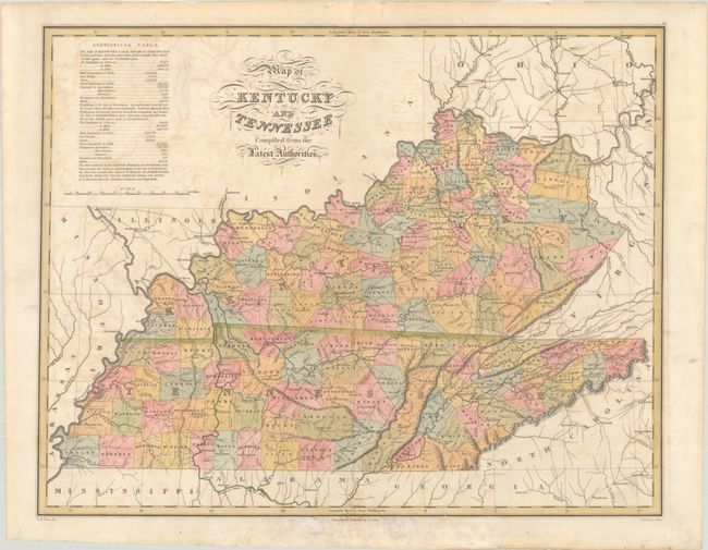
This attractive map was drawn by D.H. Vance and engraved by J.H. Young. It shows county development in Kentucky current to 1824, with Spencer County shown, but no sign of Edmonson, Laurel, or Russell, all of which were established in 1825. Tennessee's county development is current to 1825, reflecting the updated Franklin-Marion boundary. The map presents nice detail of rivers, topography and wagon roads. Southeastern Tennessee is still Cherokee Lands. The table at top left gives 1820 population statistics divided into White, Free Blacks, and Slaves, and population growth figures from 1790 to 1820. Fancy titling.
References: Phillips (Atlases) #1378-10.
Condition: B
Contemporary color with offsetting and some minor dampstaining at bottom. Short centerfold separations at top and bottom have been professionally repaired on verso.