Subject: Atlanta, Georgia
Period: 1953 (dated)
Publication:
Color: Printed Color
Size:
32 x 32.1 inches
81.3 x 81.5 cm
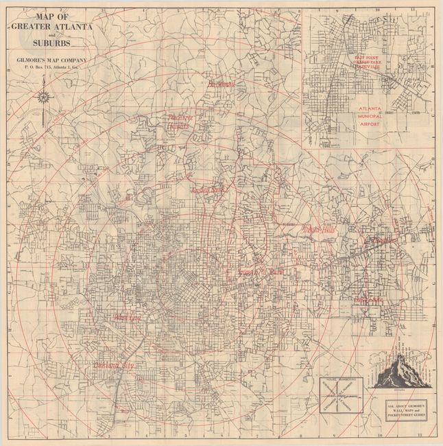
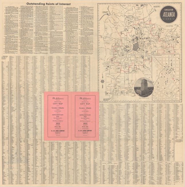
This detailed street map uses red overprinting to show 1-mile concentric circles radiating out from the Five Points intersection in downtown Atlanta. At top right is an inset map of the area surrounding the Atlanta airport. A small inset at bottom right shows the house numbering system, which is adjacent to an image of a mountain identifying the relative altitudes of various cities in the US. On verso is a street index, a list of points of interest, and a map of the greater Atlanta region. Folds into paper wrappers (5 x 8.7") with printed title. Published by Gilmore's Map Company.
References:
Condition: A
The map is issued folding with a few short fold separations. The covers have light soil.