Subject: Florida
Period: 1920 (dated)
Publication:
Color: Printed Color
Size:
47 x 42.3 inches
119.4 x 107.4 cm
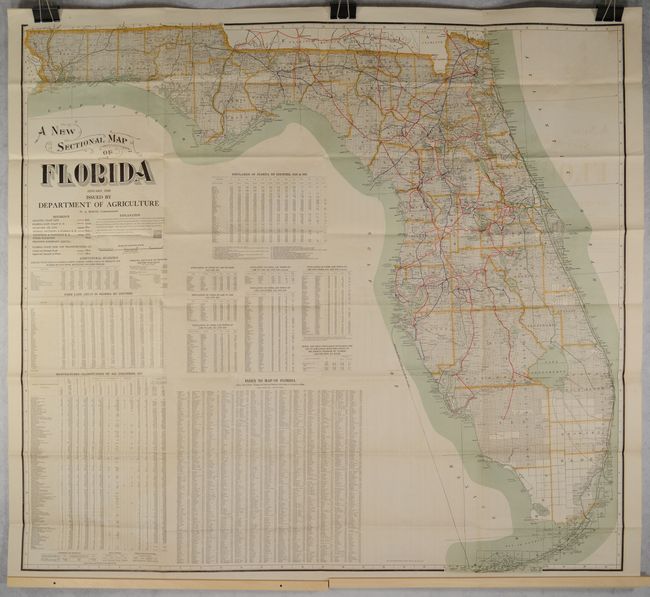
This very large folding map is delineated by county and colorfully illustrates the railroad network in the state. Locates the Atlantic Coast Line (red), Florida East Coast Railroad (green), Seaboard Airline (yellow), Georgia Southern & Florida Railroad (brown), Louisville & Nashville Railroad (olive), and more. Surveying is nearly complete, but pockets of south Florida are still undeveloped. The remainder of the sheet contains related text on county statistics, population, and farming as well as an index. Published by the Florida Department of Agriculture under the direction of W.A. McRae and lithographed by Matthews-Northrup.
References:
Condition: B+
Issued folding with light offsetting. A few short splits at the fold junctions have been repaired on verso with archival tape.