Subject: San Jose, California
Period: 1876 (published)
Publication: Historical Atlas Map of Santa Clara County, California
Color: Hand Color
Size:
26.2 x 16.5 inches
66.5 x 41.9 cm
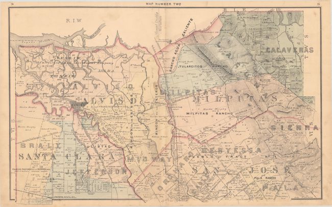
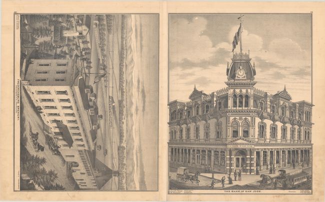
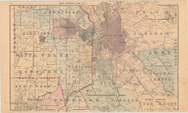
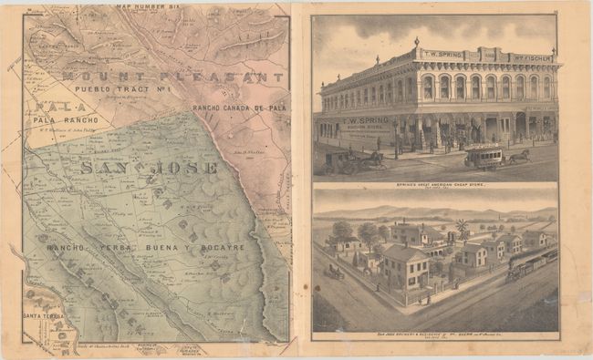
This interesting pair of maps were published in Thomson & West's atlas on Santa Clara County. Map Number Two shows the districts of North San Jose including Alviso on the San Francisco Bay, now a neighbor to several tech corporate campuses. Parts of Santa Clara (the city), Milpitas, and Calaveras are named. On verso are stunning engravings showing the Bank of San Jose and Fredericksburg Brewery. Map Number Five zooms out to situate the cities of Santa Clara and San Jose (both shown in grid plan form) in their greater context, extending as far south as Saratoga and Cambrian Park and from Steven's Creek east to Silver Creek and Evergreen. On verso is Map Number Six, a single-page map detailing the area around Silver Creek, Evergreen, and Mount Pleasant, and views of Spring's Great American Cheap Store and San Jose Brewery. The maps include remarkable detail of roads, railroads, homeowner plots (with owner names), ranchos, and more. These are some of the earliest published maps of San Jose and vicinity.
References: Rumsey #2256.008 & 2256.017.
Condition:
The first map is in B+ condition with light soiling and a few short separations and edge tears that have been closed on verso with archival tape. The second map is in B condition with light soiling, a few small dark spots at bottom, and some edge tears that have been partially closed with archival tape on verso, the longest of which extends 7" into map image at right. The sheet has been trimmed at bottom with a tiny amount of image loss.