Subject: Grand Canyon, Arizona
Period: 1927 (dated)
Publication:
Color: Printed Color
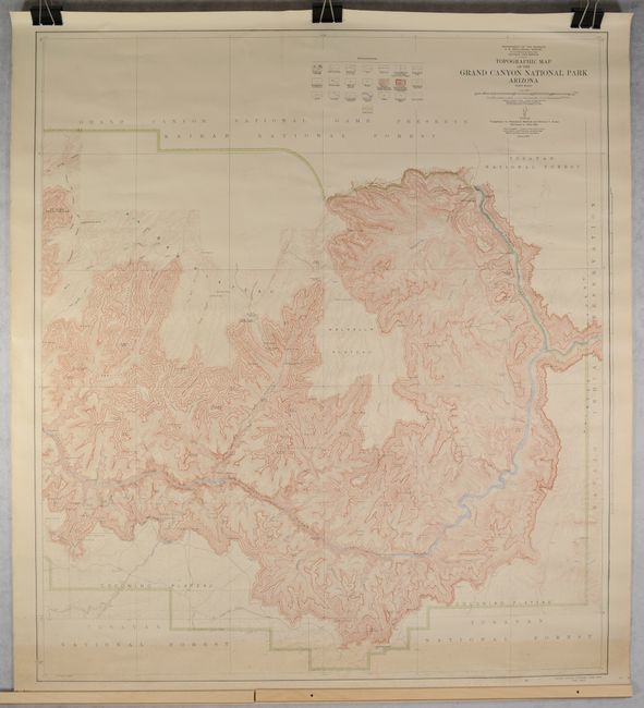
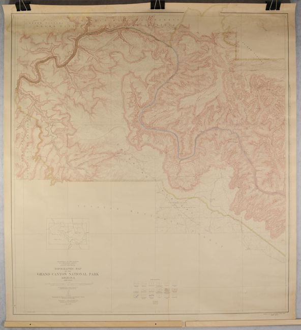
This is the first edition of this remarkably detailed two-sheet map of the Grand Canyon National Park. The topography is based on the comprehensive surveys of Francois E. Matthes and Richard T. Evans conducted between 1902-1923. The map shows the park bounded in the north by the Grand Canyon National Game Preserve and Kaibab National Forest and in the south by Tusayan National Forest. The key identifies roads and buildings, cliff dwellings, trails, railroads, reservation lines, mines or quarries, contours, sand, streams, lakes, and more. That this map was reissued in 1939 and again in 1948 is a testament to the skill and accuracy of Matthes and Evans' survey. The eastern sheet measures 38.2 x 42.6" and the western sheet measures 39.4 x 43.7".
References:
Condition:
The eastern sheet is in B+ condition with light toning and foxing along the bottom edge of the map image. The western sheet is in B condition with moderate dampstaining and light foxing along the top edge and a narrow line of light soiling at the bottom. There are 3 tears in the map image at top and 2 in the blank margins, all of which have been closed on verso with archival materials. Both maps have been tightly rolled and do not lay flat.