Subject: Southwestern United States
Period: 1864-73 (dated)
Publication:
Color: Hand Color
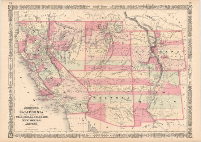
A. Johnson's California, with Territories of Utah, Nevada, Colorado, New Mexico, and Arizona, by Johnson and Ward, from New Illustrated Family Atlas, dated 1864 (23.6 x 17.0"). Johnson’s maps of the American Southwest occupy a temporal crossroads in the cartographic history of the United States after California statehood, before the adjacent territories formalized their boundaries, and before the transcontinental railroad was completed. The many different states of this map show dramatic and rapid changes. Besides the transitional territorial boundaries, the maps are of interest for the depiction of Pony Express routes, wagon trails, military expedition routes, the locations of gold and silver mines, Indian tribes, and much more relating to the geography and history of the region.
The primarily Texan immigrants in the southern part of New Mexico sought to form a separate territory as early as 1856. But it wasn’t until the organization of the Confederate Territory of Arizona that serious consideration was given to the territory in Congress in 1863. The formation of the territory with a north-south border at the 109th meridian rather than an east-west one had the effect of splitting the Confederate support and securing the region where gold had been recently discovered in the Bradshaw Mountains.
This is the early 1864 edition in this series of maps. Arizona still has the county configurations of the old New Mexico Territory, with the addition of Castle Dome and Ewell counties in the south. The Utah/Nevada border is now at 115°. This is a completely new plate with many changes in watersheds and mountain detail with several of the earlier notations removed. Condition: Contemporary color with faint offsetting and a hint of toning along the centerfold.
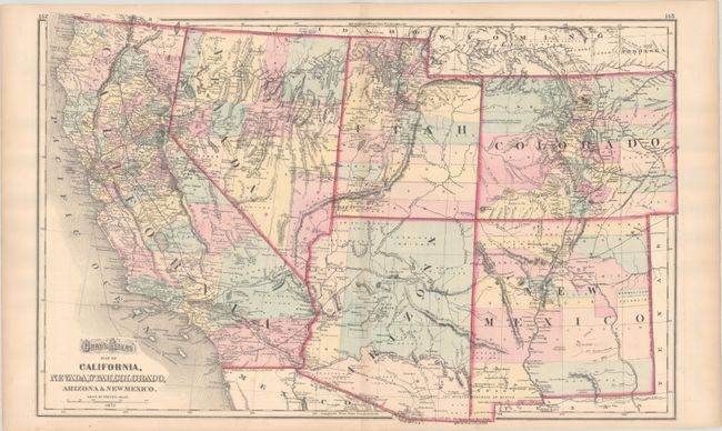
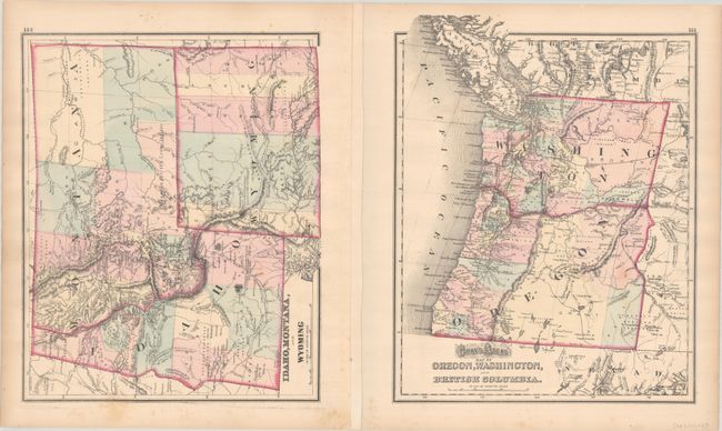
B. Gray's Atlas Map of California, Nevada, Utah, Colorado, Arizona & New Mexico, by Ormando Willis Gray, from Gray's Atlas of the United States, dated 1873 (25.5 x 16.3"). This handsome atlas map details the counties of the American Southwest. It appeared only in the first edition of Gray's atlas. Although the map is dated 1873, county configuration in Arizona predates the formation of Maricopa in 1871. In addition to towns and cities, there is excellent detail of the region's railroads, forts, Indigenous lands, mines, and more. There are interesting notes on the Gadsen Purchase, the site of Gunnison's death, the landscape of Summit County in Colorado ("Elevated plain, fertile, gently rolling with fresh water, lakes and timber), and various boundaries. On verso are Gray's Atlas Map of Oregon, Washington, and British Columbia and Idaho, Montana, and Wyoming, each with their own revelatory details. Condition: Contemporary color with faint offsetting and marginal toning.
References:
Condition: A
See description above.