Subject: Western United States
Period: 1883-85 (circa)
Publication:
Color: Hand Color
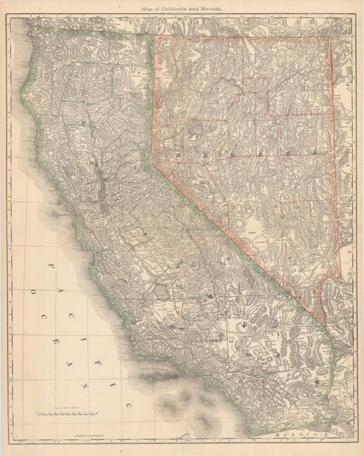
A. Map of California and Nevada, by Hiram H. Hardesty, circa 1883 (19.3 x 23.6"). A large and incredibly detailed folding atlas map of the region. It shows countless intricate details including counties, roads, railroads, cities, towns, mountains, rivers, lakes, mines, missions, reservations, and much more. Condition: Issued folding on banknote paper with a minor crease at lower left.
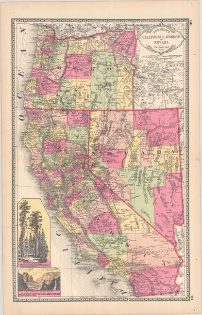
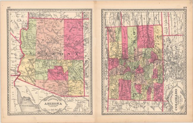
B. Tunison's California, Oregon and Nevada [on verso] Tunison's Colorado [and] Tunison's Arizona, by H. C. Tunison, circa 1885 (12.6 x 20.1"). This wax engraved map is unusual for its use of late hand coloring, a laborious process that was largely abandoned two decades earlier. Beyond the brightly colored counties, the map shows good detail of the railroad network and is further embellished by insets of Yosemite and the Redwoods. The verso contains equally vibrant single-page maps of Colorado and Arizona. Condition: A bright and vivid example.
References:
Condition: A
See description above.