Subject: Central United States
Period: 1854 (dated)
Publication:
Color: Hand Color
Size:
27.4 x 22.2 inches
69.6 x 56.4 cm
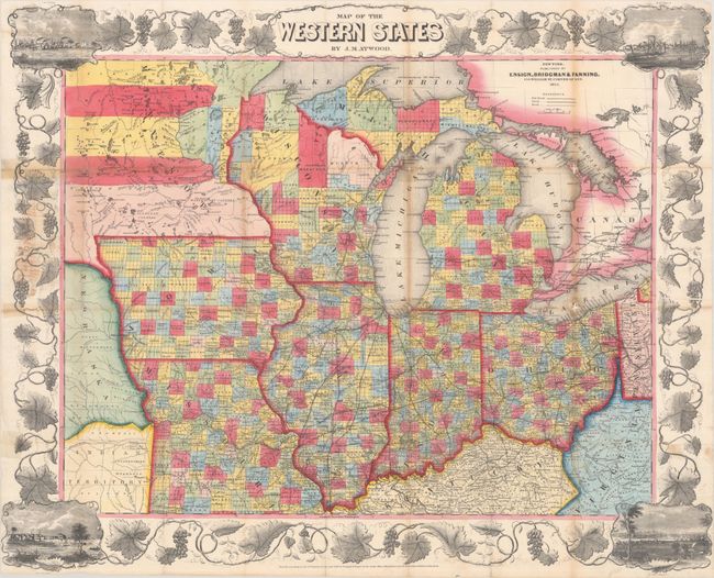
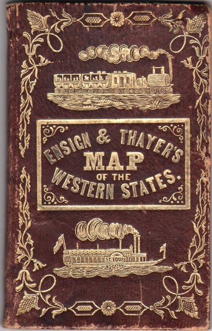
This uncommon pocket map is accompanied by "Ensign & Thayer's Travellers' Guide through the States of Ohio, Michigan, Indiana, Missouri, Iowa, and Wisconsin...". The lithographed map was published in New York by Ensign, Bridgman & Fanning, and presents the rapidly evolving transportation network including railroads, canals and wagon roads. It is surrounded by a wide grapevine border that incorporates vignette views of Chicago, St. Louis, Cincinnati, and Detroit at the corners. Includes a 35-page traveler's guide that gives descriptions and routes for each state and territory on the map. This edition also includes a 1-page section on California despite it not being on the map, attesting the importance of the new state and the Gold Rush. Accompanying covers feature embossed gilt titling, fancy tooling and illustrations of a locomotive and steamship.
References:
Condition: B
Issued folding with several short fold separations that have been closed on verso with old tape. There is light toning along the folds, staining in the decorative border at left, and minor loss at a number of fold junctions. Covers are rubbed along the edges.