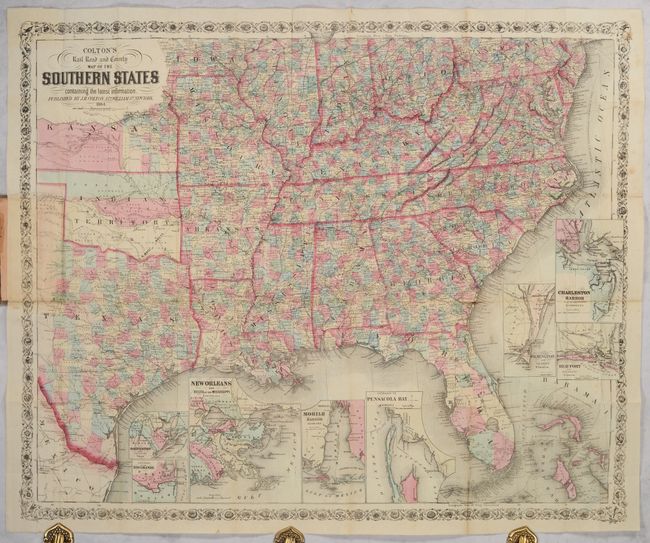
Subject: Southern United States, Civil War
Period: 1864 (dated)
Publication:
Color: Hand Color
Size:
32.8 x 26.8 inches
83.3 x 68.1 cm
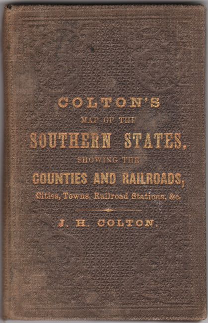
This scarce Civil-War era pocket map extends from New York City south to Florida and west to Texas, Indian Territory and Kansas. While the map makes no mention of the Civil War or Confederacy, it is nevertheless highly detailed showing counties in hand color, towns, court houses, railroads, canals, rivers and much more. West Virginia, which had seceded from Virginia the year prior (1863), is labeled Western Virginia with no formal border yet separating it from Virginia. The Atlantic Ocean and Gulf of Mexico are filled with 8 insets of important southern ports including New Orleans, Mobile, Pensacola and Charleston, which were key locations for the Union blockade strategy implemented during the war. Surrounded by a decorative border. Folds into brown cloth covers (3.7 x 5.9") with gilt title on the front cover. A scarce map issued near the end of the American Civil War.
References:
Condition: B+
Issued folding with contemporary color. There are a few short fold separations and minor foxing in the right blank margin. Front cover is dampstained and the spine has a small tear at top.