Subject: Colonial Southeastern United States
Period: 1781 (published)
Publication: Teatro della Guerra Marittima e Terrestre
Color: Hand Color
Size:
10.8 x 7.1 inches
27.4 x 18 cm
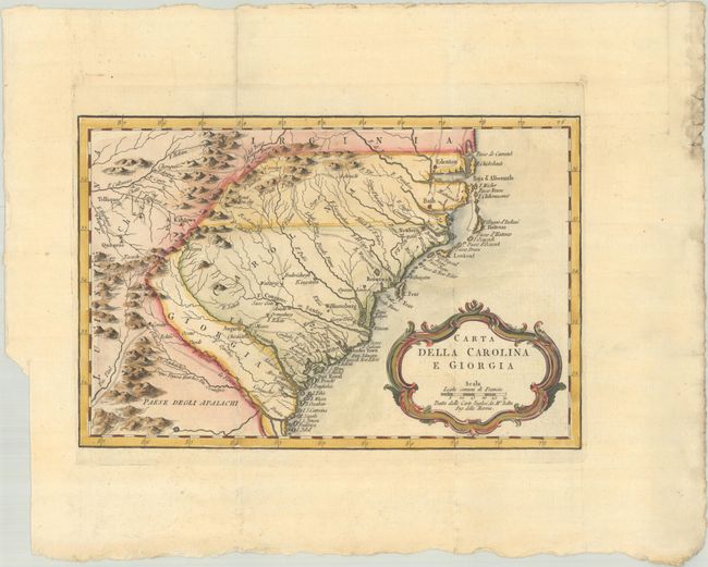
This is an uncommon Italian edition of Bellin's map of the colonies of Carolina and Georgia from Albemarle Sound to the Alatamaha River. This Italian edition is a close copy of Bellin's map first published in 1757 and re-issued in 1780, which itself appears to have been based on the 1752 map of the region by Emanuel Bowen. However, there are two notable additions to this Italian map: boundary lines between the states and early roads in the region. There are numerous English settlements along the coast, and Indian villages are located throughout, including a number west of the Appalachian Mountains. It shows a rudimentary course of the Tennessee River in the northwestern section of the map. A decorative rococo-style title cartouche incorporates the distance scale. Published in Teatro della Guerra Marittima e Terrestre, atlas to accompany Storia delle Rivoluzione dell' America Inglese by Formaleoni.
References: cf. Cumming (SE) #311; Phillips (Atlases) #348-31.
Condition: A
A crisp impression, issued folding on a bright, watermarked sheet. There is a binding trim at bottom left and soiling and chips at top right, all well away from the image.