Subject: New England United States, New York City
Period: 1852 (published)
Publication: Manual of the Corporation of the City of New York
Color: Black & White
Size:
7.2 x 11.7 inches
18.3 x 29.7 cm
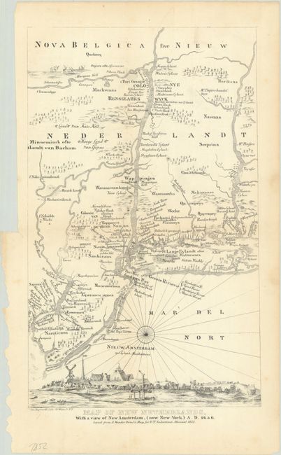
This is a 19th century facsimile of Evert Nieuwenhof's 1656 map of the region between the Delaware and Connecticut Rivers, which is often attributed to Adriaen Cornelissen van der Donck. Nieuwenhof based the map on Nicholas Visscher's map of the region, closely copying his view of New York City, which shows the southern tip of Manhattan Island as a small settlement dominated by a Dutch fort and the buildings of the Dutch West India Company.
George Hayward was a New York City lithographer best known for his views and maps of New York City, including those published in D.T. Valentine's annual manuals for the city between 1841 and 1866. The manual was a directory with extensive historical and contemporary records related to New York, including ordinances, lists of public officials, ferry schedules, and the directories of hospitals and schools.
References: cf. Burden #317.
Condition: B+
A lightly toned sheet, issued folding with a couple of minor spots and two tiny holes along the edge of the map.