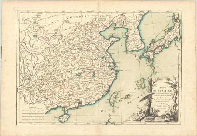
Subject: China, Korea & Japan
Period: 1762 (published)
Publication: Atlas Moderne
Color: Hand Color
Size:
17.6 x 12.3 inches
44.7 x 31.2 cm
Beautifully engraved, decorative map of the Chinese Empire that includes Taiwan, Coree, and Haynan. It extends to include the Korean Peninsula and the southern islands of Japan, showing an oversized Okinawa (Lequeo). The decorative rococo-style cartouche features a Chinese gentleman sitting under a parasol, holding a bird and smoking a pipe.
Rigobert Bonne was an important French cartographer of the late 18th century. In 1773 he succeeded Jacques Bellin as the royal cartographer in the office of the Hydrographer at the Depot de la Marine. Working in his official capacity, Bonne compiled some of the most detailed and accurate maps of the period.
References:
Condition: A
A crisp impression with contemporary color on a watermarked sheet with a couple of minor spots and several tiny worm holes, two of which are in the image.