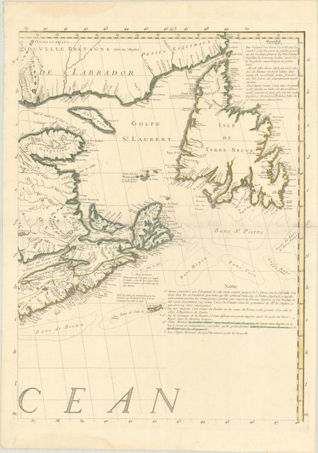
Subject: Eastern Canada
Period: 1756 (circa)
Publication:
Color: Hand Color
Size:
19.4 x 25.9 inches
49.3 x 65.8 cm
This is the upper right sheet from a French edition of John Mitchell's monumental map of eastern North America published by George Le Rouge. The complete map is considered by many to be the most important map of America ever produced. It was so widely regarded that it was used as the source document to determine the new boundaries of the United States at the Treaty of Paris in 1783. The map continued to be used for nearly all boundary disputes between Canada and the United States in the 19th century.
This sheet covers eastern Canada including New Brunswick, Nova Scotia, Newfoundland, and the southern coastline of Labrador. Notes at right explain that French possessions are in blue, English possessions in yellow, and disputed lands are colored green. Cartographically, the map depicts the important fishing banks off of Newfoundland and presents good detail of the rugged coastlines, numerous French and English settlements, rivers, topography, notations, and more.
This sheet was issued in a dual French/German edition of the map with a German notation at the upper right of this sheet. Since the publication date is not on this sheet, the circa date of 1756 was used (second French edition with alternate German title). This is a nice opportunity to own an important piece of this monumental map.
References: McCorkle #756.11; Sellers & Van Ee #46; cf. Pritchard & Taliafero #33.
Condition: A
A crisp impression with contemporary outline color on a watermarked sheet featuring a Maltese Cross encircled in rosary beads. There is a printer's crease at left, faint dampstains in the upper and lower blank margins, and a short centerfold separation confined to the right blank margin that has been closed on verso with archival tape.


