Subject: Caucasus
Period: 1787-91 (published)
Publication:
Color: Black & White
Size:
9.5 x 7.5 inches
24.1 x 19.1 cm
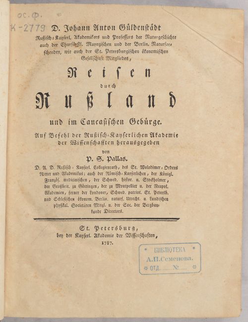
This is Johann Anton Güldenstädt's rare and important study on the Caucasus, published in two volumes. Güldenstädt was a German naturalist and explorer who was employed by Catherine II of Russia to explore the southern frontier of the Russian Empire beginning in 1768. He traveled through the regions of the Ukraine, the northern Caucasus, and Georgia, observing the geography, geology, flora, and fauna, as well as the people, their customs, and their government. Upon returning to St. Petersburg in 1775, he began writing of his discoveries, publishing several geographical, historical, and natural history works, including the first description of a jungle cat (also known as a reed cat). He died of fever in 1781 before his complete account of the expedition could be published, and his notes were then published posthumously by Peter Simon Pallas, who was also a member of the Russian Imperial Academy of Sciences.
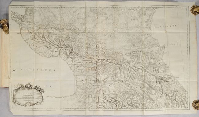
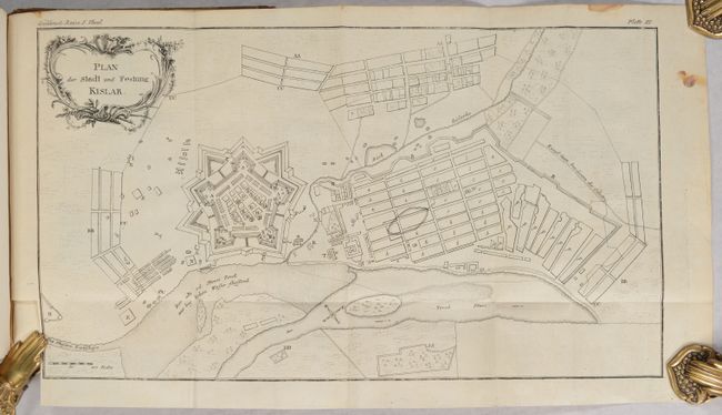
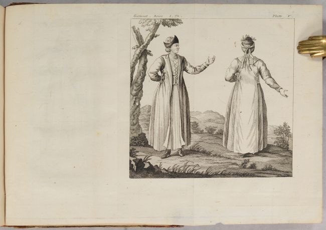
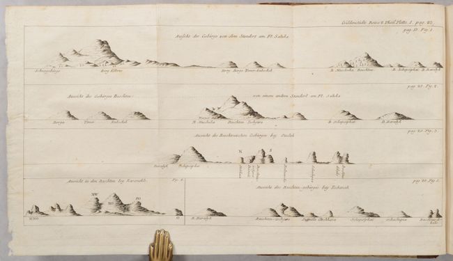
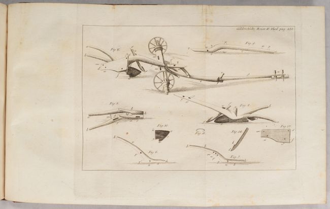
This two-volume work includes 4 maps and 23 engravings. The largest map, Neue Carte des Caucasus Groestentheils aus Gueldenstaedts... (29.5 x 16.8"), depicts the entire Caucasus and is printed on two joined sheets. It features incredible topographical detail and notes towns, roads, rivers, and political boundaries. Another map, Plan der Stadt und Festung Kislar (17.2 x 9.6"), is a bird's-eye plan of the town of Kizlyar along the Terek River. The engravings in the volumes depict costumed figures, plows and other farm tools, iconography, and land approach views.
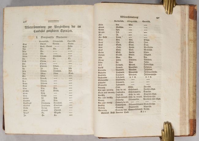
Also of importance is an extensive dictionary at the end of volume 2 that translates German words into three common languages in the Caucasus (primarily in Georgia): Svan, Mingrelian, and Kartvelian. Güldenstädt's work was instrumental in aiding Russia in expanding its influence in the Caucasus, including the 1783 Treaty of Georgievsk, which established eastern Georgia as a protectorate of Russia, and Russia's conquests of the Caucasus in the 19th century.
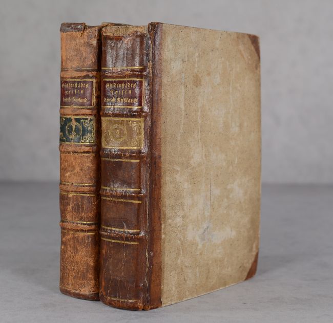
Octavo. Volume 1 was published in 1787; III-XXIV, 518 pp., 2 maps, 11 engravings. Volume 2 was published in 1791; 552 pp., 2 maps, 12 engravings. Quarter leather with tips over speckled paper-covered boards; 5 raised bands on spine with red and green leather title labels with gilt tooling on volume 1, and red and gold leather title labels on volume 2.
References:
Condition: B+
Overall the maps and plates are in excellent condition with occasional offsetting, soiling, or a spot of foxing. The large map is a crisp impression on bright sheets with minor mis-folding, a bit of soiling above the title cartouche, and two 2" binding tears at left. One of the folding plates of iconography in volume 1 has a 3" binding tear at left. The text has light toning and occasional foxing or manuscript notations. There is an old library stamp on the title page of each volume. The covers are worn and stained with bumped corners. The spines are worn and cracked with some small chips.