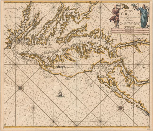
Subject: Colonial Chesapeake & Delaware Bays
Period: 1695 (circa)
Publication: Zee-Fakkel
Color: Hand Color
Size:
23.1 x 20.3 inches
58.7 x 51.6 cm
A scarce coastal chart of the Chesapeake and Delaware Bay region, extending south to Cape Henry and north to southern New Jersey and Pennsylvania. The new settlement of Philadelphia is noted as Filadelfy, a very early naming of the city. The cartography is based on Augustine Hermann's rare map of 1670, known in only a handful of examples, which succeeded the John Smith map of the region as far as accuracy and detail. The individual settlements are depicted along the coastline, and soundings and shoals are noted. Although the geography is largely based on Hermann's map, the soundings and nomenclature are derived from unknown, but likely Dutch and English, sources. A compass rose orients north to the right, and a lone ship sails the sea. The title cartouche is flanked by a pair of allegorical figures. Engraved by C. J. Voogt. This is the third state with the page number "19" engraved in both lower corners.
References: Burden #588; Wooldridge #64.
Condition: B+
A sharp impression on a sheet with minor toning, faint offsetting, and a narrow top margin, as issued.