Subject: Atlases
Period: 1808 (published)
Publication:
Color: Hand Color
Size:
14.6 x 21.6 inches
37.1 x 54.9 cm
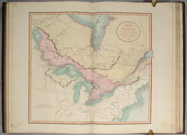
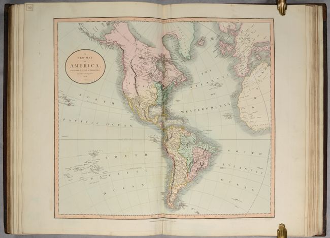
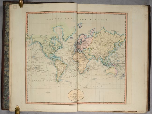
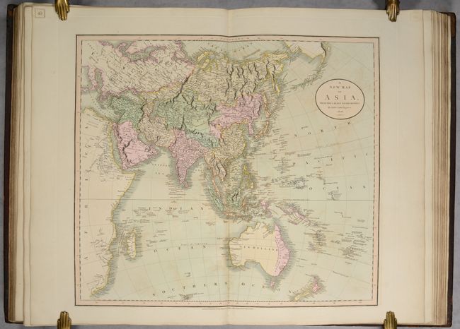
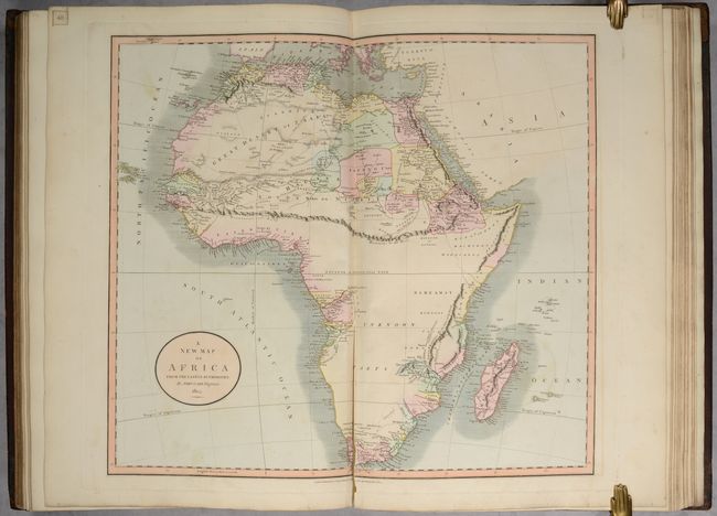
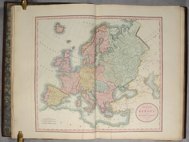
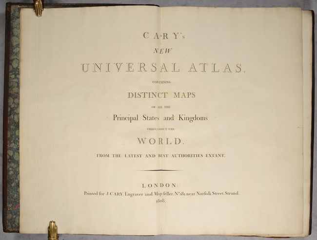
This large, complete atlas contains 60 double-page maps. Cary's atlas was one of the finest of the period and served as source material for American mapmakers. David Rumsey notes that "[Henry] Tanner directly copied the World and continental maps for his New American Atlas." The atlas features maps of the world, hemispheres, 5 continents, and regional maps of Europe (35), Asia (7), Africa (1), and North America (8). Maps of the Russian Empire and South America are printed on two double-page sheets, while the map of Scotland is presented on four double-page sheets. Of particular interest are the following:
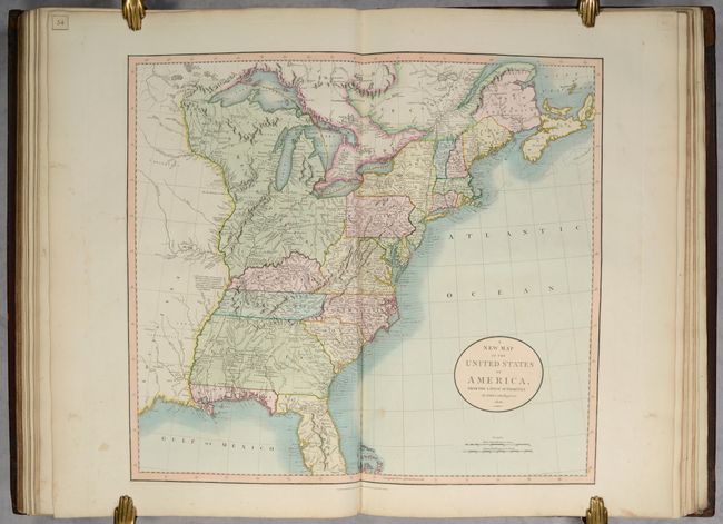
A. A New Map of the United States of America, from the Latest Authorities. This handsome map is one of the best maps of the United States to appear in the early part of the nineteenth century. It covers the country from the Atlantic Ocean westward to the Mississippi River, beyond which is a small portion of Louisiana Territory. The huge Western Territory is comprised of today's Minnesota, Wisconsin, Illinois, Indiana, Ohio and Michigan. The 1795 Boundary Line by the Treaty of Grenville is delineated across present-day Ohio. The District of Main is drawn from the British point of view with the northern portion incorporated into Lower Canada and New Brunswick. The huge Georgia Territory stretches to the Mississippi River, incorporating present-day Alabama and Mississippi. Florida is divided into the Spanish possessions of East and West Florida. The map is filled with place names, forts, Indian villages and hunting grounds, roads and interesting notations.
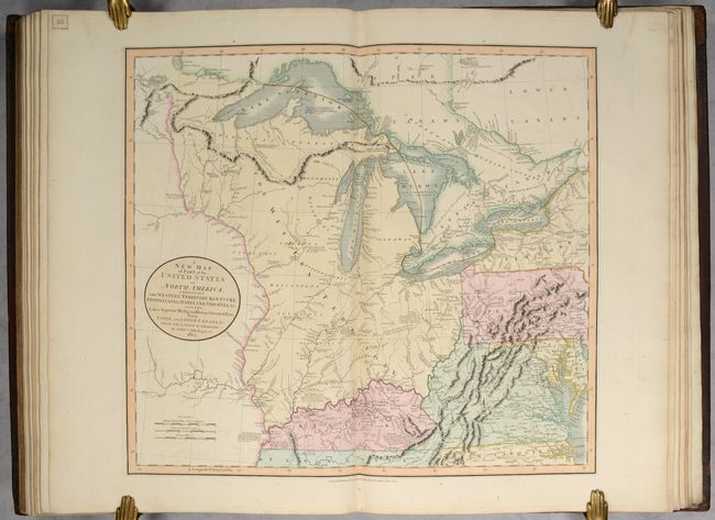
B. A New Map of Part of the United States of North America, Exhibiting the Western Territory, Kentucky, Pennsylvania, Maryland, Virginia &c. Also, the Lakes Superior, Michigan, Huron, Ontario & Erie; with Upper and Lower Canada &c. This map shows the early frontier during a period when the young United States was rapidly settling the territory between the Allegany Mountains and its boundary on the Mississippi River. The present-day states of Michigan, Indiana, Ohio, Illinois, Wisconsin and part of Minnesota are all contained within the large Western Territory. Lake Superior still shows the imaginary Isle Philippeaux, and native tribes are named throughout the map. Bounty Land Grants for the Illinois Company and the Wabash Company are named near the Illinois and Wabash rivers. Navigational and historical notes are scattered throughout the map, and roads are well-delineated. One of the most interesting of those notations is one in Kentucky that describes the region discovered by J. Macbride in 1754, explored by Daniel Boon in 1769, and settled by Boon and 'five others' in 1773.
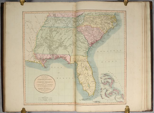
C. A New Map of Part of the United States of North America, Containing the Carolinas and Georgia. Also the Floridas and Part of the Bahama Islands &c. from the Latest Authorities. This is a wonderful map of the Southeast issued during a period of rapid change and advancement. East and West Florida exist as separate territories. West Florida was not annexed into the United States until 1810. Portions of it became Louisiana, Alabama and Florida. The map is filled with information on the roads, portages, forts, Indian villages, settlements and topography. It is also remarkable for the many interesting notes, including the Principal Hunting Grounds of the Western Party and Six Villages in Mississippi, here shown as part of the large Georgia Territory. In Florida, Fort St. Marks, Apalacha Fort, and the roads from St. Augustine are shown, with a note that the Apalachees Villages are now almost all deserted. Southern Florida is labeled Ancient Tegesta. A lake and river system connects Mayaco Lake (Lake Okeechobee) with the St. Johns River. The map extends to provide good detail of the Bahamas including a notation on Guanihani or Cat Island that it was the first Land of America Discovered by Columbus - a common misconception of the period.
The atlas also includes a double-page title page and a list of maps that was engraved on a separate sheet and pasted onto the front free-endpaper. Hardbound in quarter leather over marbled paper-covered boards with gilt embossed bands and titling on spine and marbled endpapers. It appears that the boards may be contemporary and were previously full leather, with the marbled paper added at a later date. The spine has been rebacked. A well-preserved example of Cary's atlas.
References: Phillips (Atlases) #714; The Map Collector #43, pp. 40-47.
Condition: B+
The maps are on bright sheets with superb, full contemporary color. The maps range in condition from near fine (A) to very good (B+) with occasional offsetting and soiling. The map of Scandinavia has a short tear that enters the image at bottom, and the map of Africa has a long centerfold separation at bottom. There are minor edge tears on a few maps that do not enter the image, and a few sheets have heavy soiling along the far edges. Includes printed bookplate of "William M. Maude" on inside front cover. The sturdy covers are heavily worn, stained and scuffed. The modern spine shows some light cracking.