Subject: Cape of Good Hope, Southern Africa
Period: 1726 (circa)
Publication: Oud en Nieuw Oost-Indien
Color: Black & White
Size:
21.9 x 17.4 inches
55.6 x 44.2 cm
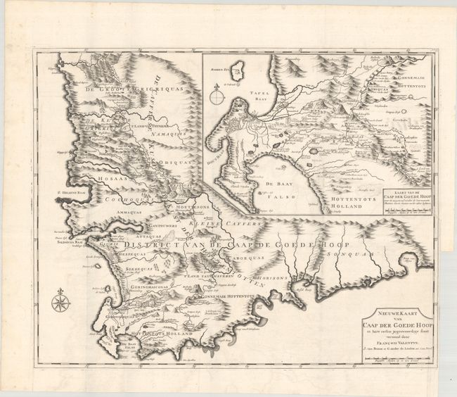
This superb map of the Cape of Good Hope is one of the most important primary sources for information on the region. It was published in Francois Valentyn's immensely important history of the Dutch East Indies. Valentyn was a Minister of the Dutch Reformed Church who served with the Dutch East India Company. He obtained information for his map from the Dutch government at the Cape. The map covers the Western Cape and the Cape of Good Hope to just past Algoa Bay in the east. It is distinctively engraved to illustrate the settled areas, mountains, and rivers, with names of tribes and villages carefully noted. The large-scale inset, Kaart van de Caap der Goede Hoop..., provides a wealth of information on Cape Town and False Bay, including the names and locations of individual farmers, roads, and topography. This influential map was copied by several other cartographers throughout the 18th century.
References: Norwich #214; Shirley (BL Atlases) G.VALN-1a #61.
Condition: B+
A crisp impression on watermarked paper with minor offsetting and a binding trim in the right margin with an associated tear that enters 1" into map image, now closed with archival tape on verso.