Subject: Morocco
Period: 1766 (circa)
Publication: The Fifth Part of the General English Pilot
Color: Hand Color
Size:
21 x 17.1 inches
53.3 x 43.4 cm
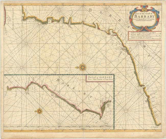
This handsome and uncommon sea chart covers the coast of Morocco from the Strait of Gibraltar and Tangier south to Cap Cantin. Place names and landmarks are identified along the coastline, including Sallee, Anafe (Casablanca), a couple towers, and a castle. Navigational information like soundings, anchorages, and hazards fill the waters off the coast. The chart is crisscrossed with rhumblines, and a compass rose orients north to the left. An inset at bottom extends the map's coverage farther south to the vicinity of Agadir, with a Mores Castle located nearby. An attractive strapwork title cartouche appears at top right, with three distance scale below it.
References: Shirley (BL Atlases) M.M&P-6a #5.
Condition: B+
A nice impression on a thick sheet with a Strasburg bend and lily watermark. There is light soiling, a printer's crease at right, and minor abrasions, with tiny areas of image in facsimile. The sheet's left edge is reinforced with old paper on verso.