Subject: Reunion, Indian Ocean
Period: 1775 (circa)
Publication: Le Neptune Oriental
Color: Black & White
Size:
13.2 x 19.2 inches
33.5 x 48.8 cm
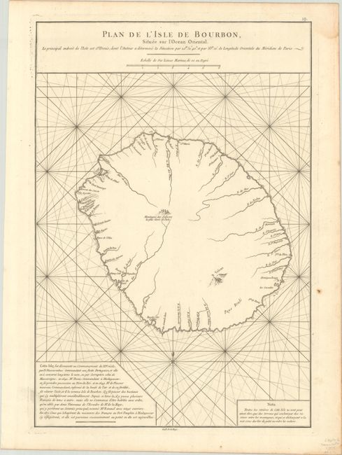
This uncommon chart is one of very few early maps to focus on Reunion. The geography of the island is minimal, focusing on key rivers that flow to the coastlines and a volcano (Piton de la Fournaise). A note at bottom left describes the history of the island, which was discovered by the Portuguese in the 16th century and claimed by France in 1642. The French named the island after the House of Bourbon and begin populating it. The island was named Reunion in the mid-nineteenth century.
A French sailor and hydrographer, D' Après de Mannevillette (1707-1780) used new instruments to correct the latitudes measured by previous explorers. His atlas Le Neptune Oriental, first published in 1745, was considered a major achievement and an indispensable resource for navigators.
References: Shirley (BL Atlases) M.APR-1c.
Condition: A
A crisp impression on a bright sheet with a birdhouse watermark. There is a small rust spot in the right margin and a faint dampstain at top right, neither affecting the image.