Subject: Malaysia
Period: 1796 (dated)
Publication:
Color: Black & White
Size:
12.8 x 18.8 inches
32.5 x 47.8 cm
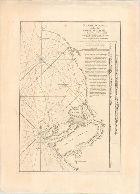
This rare chart covers Selangor on the west coast of Peninsular Malaysia, in the vicinity of present-day Kuala Lumpur, Port Klang, and Klang (all not yet established at the time of publication). It spans from Point Caran (Tanjong Karang) south to Parcelar Hill near the Langat River, centering roughly on the mouth of the Klang River. There is plenty of navigational information in the Straits of Malacca, including depth soundings, banks, breakers, bottom types, an anchorage, and several small islands; additional navigational directions appear in English text below the title. Coastal profile views along the right edge of the chart depict the hilly sights from the vantage of the Selangor Road, the approach to the mouth of the Selangor River. Based on the French hydrographer Apres de Mannevillette's Plan de Salangor et de la Cote de Malaye, this chart has been corrected based on contemporary English draughts.
References:
Condition: B+
A nice impression with a few light spots and minor toning. There are edge tears confined to the blank margins.