Subject: Central Europe, Germany
Period: 1703 (circa)
Publication: Atlas Novus
Color: Hand Color
Size:
14 x 9.2 inches
35.6 x 23.4 cm
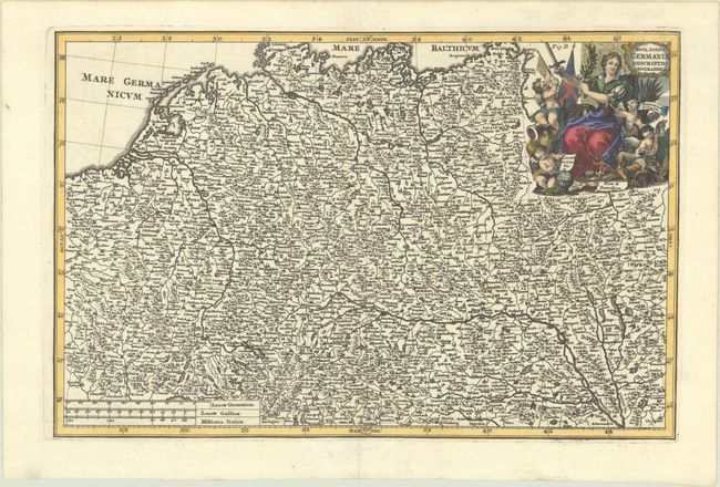
This beautifully engraved map of the Holy Roman Empire covers a large area, spanning from the Baltic Sea south to Zagreb, and from the Oise in France east to Lviv. It is packed with place names and detail of the region's rivers and mountains. The decorative title cartouche at top right incorporates allegorical figures and symbols representing Bellum Pacemos (War & Peace), Scientias & Artes (Sciences & Arts), Frumentum & Vinum (Grain & Wine), and Fera & Domestica (Wild & Domestic). Three distance scales appear at bottom left.
References: Shirley (BL Atlases) T.SHER-1a #68.
Condition: A+
A crisp impression on a bright sheet with minor marginal soiling.