Subject: Western Europe
Period: 1752 (dated)
Publication: Atlas Universel
Color: Hand Color
Size:
21.8 x 18.9 inches
55.4 x 48 cm
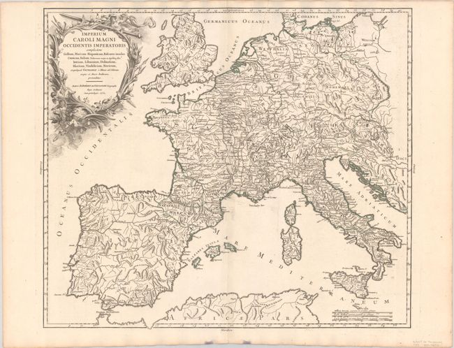
This is the first state of this attractive and detailed map of Charlemagne's empire covers western Europe including part of the Balkans plus England and Wales. The outline color distinguishes the empire. Putti frolic in the foliage that makes up the large, decorative title cartouche. The map was engraved by Delahaye, and the cartouche is the work of Haussard.
This map was the subject of controversy in a lawsuit between the engraver and publisher. Engraving was a time-consuming and expensive process involving a cast of people and numerous steps. The testimony in this lawsuit highlights how easily errors were made on maps and how often they were left uncorrected, in this case due to delays in payment for the work.
References: Pedley #93 and pp. 54-60.
Condition: A
A sharp impression with contemporary outline color on a bright sheet with a "T Dupuy Auvergne" watermark and minor offsetting along the centerfold. There are a couple of stains along the bottom edge of the sheet, well away from the image.