Subject: Low Countries
Period: 1729 (published)
Publication: Introductionis in Universam Geographiam
Color: Hand Color
Size:
9.9 x 9.6 inches
25.1 x 24.4 cm
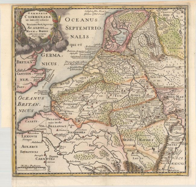
This copper-engraved map depicts the ancient tribes in the basin of the Rhine, Schelde, Mosel and Maas River valleys. The wreath-style title cartouche is flanked by gods representing the rivers.
Cluver's Introductio in Universam Geographicam was a popular atlas, appearing in over 45 editions during a 100-year period. The first edition was published without maps in the 1620s, and the first edition to include maps was published circa 1641. The various editions were published in different cities throughout Europe, including Amsterdam, Nuremberg, and London. This map is from an Amsterdam edition, edited by Bruzen de la Martiniere with maps by Jan Wolters and four newly engraved maps after Delisle.
References: Shirley (BL Atlases) T.CLUV-8b.
Condition: A
A dark impression, issued folding on a bright sheet with an Amsterdam arms watermark. There is a binding trim at left and a narrow top margin, as issued.