Subject: Southern Sweden
Period: 1897 (dated)
Publication:
Color: Black & White
Size:
39.7 x 28.6 inches
100.8 x 72.6 cm
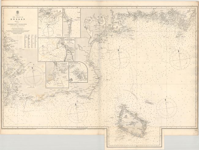
This scarce chart from the Hydrographical Office of the British Admiralty is based on a Swedish survey by Admiral Gustaf Klint. The chart focuses on the southern tip of Sweden from Landskrona to the southern end of Kalmar Sound and extends to include the Danish island of Bornholm. The chart is filled with depth soundings, rocks, shoals, safe anchorages, and lighthouses, which are indicated in red and yellow hand color. Inset maps focus on Ystad, Simrishamn, Karlshamn, Ronne Harbor on Bornholm, and Ertholmene to the northeast of Bornholm. The chart includes a table translating geographical terms from Swedish to English. The southern portion of Bornholm is printed on a separate sheet and pasted onto the larger sheet. This map was first published in 1855 and includes corrections to 1897.
References:
Condition: B+
An excellent impression with some light stains at left and soiling along the sides of the sheet. The lighthouses are colored with contemporary hand color.