Subject: Southeast England
Period: 1777 (dated)
Publication: The Royal English Atlas
Color: Hand Color
Size:
19.7 x 16.1 inches
50 x 40.9 cm
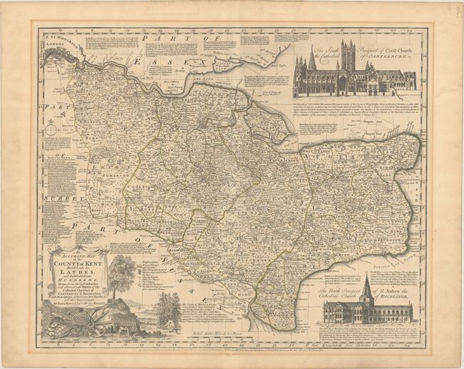
This richly detailed and densely annotated map of Kent divides the county into its lathes and hundreds. A key identifies rectories, vicarages, and curacies; "buro'" towns (along with the number of members they send to Parliament); charity schools; religious houses; post stages; measured distances; and market days. Notes surround the map, with information about Rochester, Canterbury, the earls of Kent, Maidstone, Dover, and more. London is shown in miniature plan form at top left. The map is decorated with two beautiful architectural views depicting Canterbury Cathedral (top right) and Rochester Cathedral (bottom right), with text describing each. A title cartouche at bottom left includes a charming landscape with an anchor, fish, and various symbols of plenitude and might.
References: Shirley (BL Atlases) T.BOW-4b.
Condition: B+
A crisp impression with contemporary outline color on a sheet with "J. Whatman" and fleur-de-lis watermarks. There is light mat burn along the border outside the map image from a previous framing and a couple pieces of masking tape along the top sheet edge on verso.


