Subject: Eastern England
Period: 1693 (circa)
Publication:
Color: Hand Color
Size:
35.3 x 18 inches
89.7 x 45.7 cm
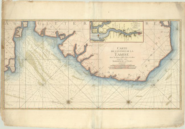
Large-scale chart of the eastern coastline of Norfolk, Suffolk and Essex, from Sheringham in the north extending south to the Isle of Thanet. The handsome sea chart is filled with navigational information at the entrance to the Thames River, including soundings, anchorages, shoals, etc. A large inset map shows the course of the Thames River from its entrance to London. Two large compass roses orient north to the right. This is a Depot de la Marine issue with the seal and the price (Prix trente Sols) below the title.
References:
Condition: B+
A nice impression on a sturdy, sheet with an eagle watermark, extraneous creasing along the centerfold, minor soiling in the image and heavy soiling along the edges of the sheet. There are some chips and tears along the edges of the sheet, with a few tears just touching the map border at left and closed on verso with archival materials.