Subject: European Countries
Period: 1869 (circa)
Publication:
Color: Printed Color
Size:
9.3 x 11.1 inches
23.6 x 28.2 cm
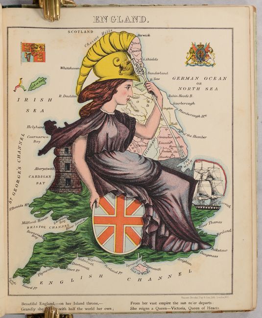
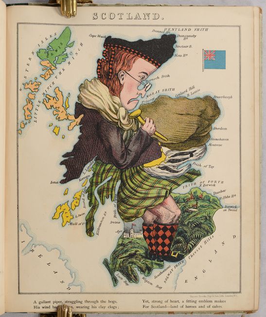
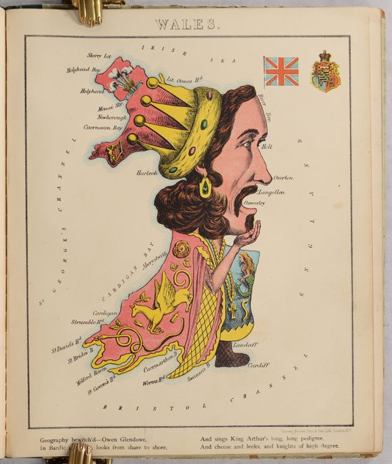
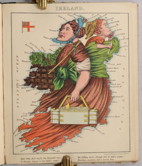
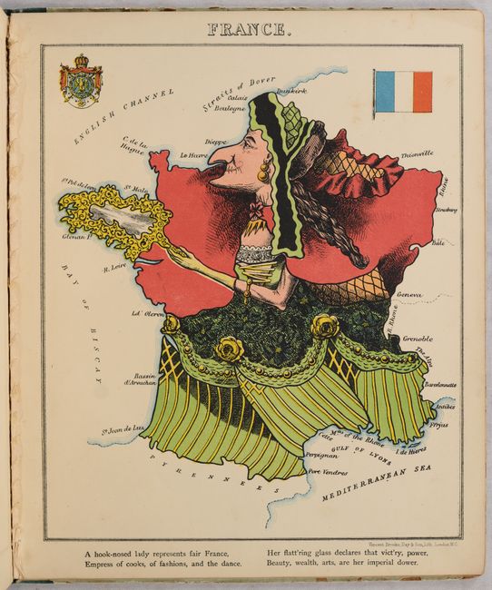
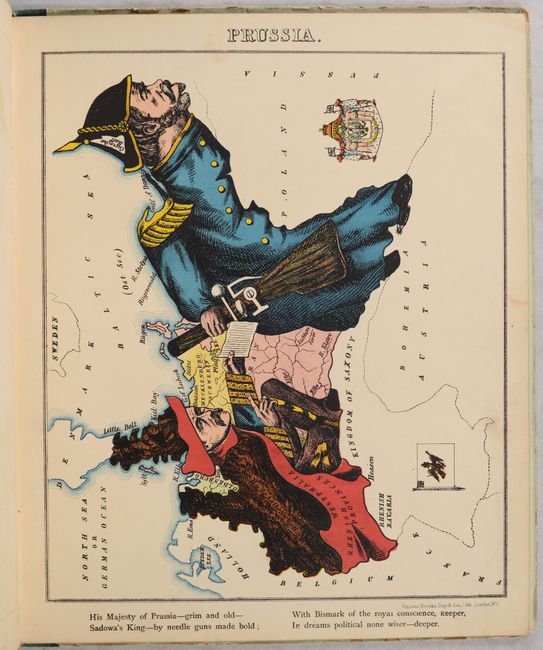
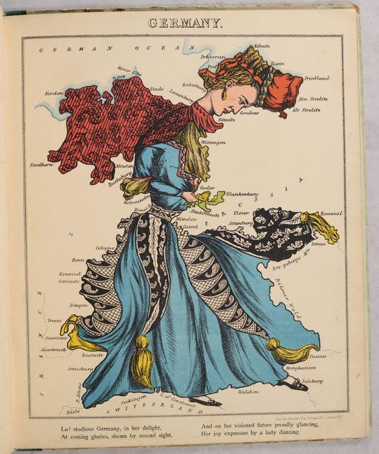
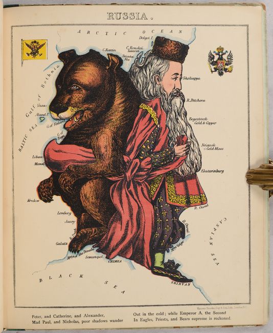
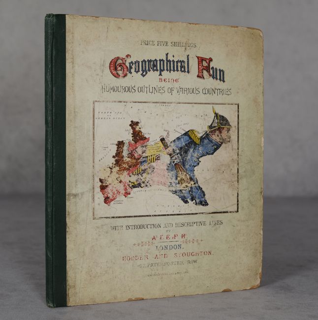
Satirical political maps appear throughout cartographic history and gained popularity in the latter part of the nineteenth century. This is the complete series of twelve maps of Europe that depicted the political geography in human form. The idea for the maps originated from Eliza Jane Lancaster (later known by her stage name as Lilian Lancaster), who made drawings as a young girl to amuse her sick brother. Aleph, the pseudonym for William Harvey, compiled the maps and wrote the verses that accompany them. According to his introduction, the illustrations were meant as a humorous, educational aid in the study of geography, rather than the political satire they became. The maps depict England, Scotland, Wales, Ireland, France, Spain & Portugal, Italy, Prussia, Germany, Holland & Belgium, Denmark, and Russia. Harvey's publication first appeared in 1868, published by Hodder & Stoughton with the maps printed by the firm of Vincent, Brooks, Day & Son.
References: Baynton-Williams (Curious Map Book), pp. 170-173; cf. Manasek #115; Slowther (Map Collector #16), pp. 48-50.
Condition: B+
The map images have bold color and light, scattered foxing. There is a tear and chip in the front free-endpaper. The text block is separated from the covers, which are heavily worn, rubbed and soiled.