Subject: Central America
Period: 1870 (dated)
Publication:
Color: Hand Color
Size:
36.3 x 24.1 inches
92.2 x 61.2 cm
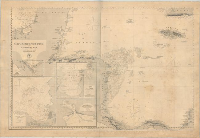
This large and highly detailed chart extends from Cozumel off the Yucatan Peninsula south through Central America to Cartagena, Columbia. It extends east across the Gulf of Mexico to include Jamaica and southwestern Cuba as well. There is particularly good detail off the Mosquito Coast, and the chart is teeming with navigational information including soundings, anchorages, bottom types, hazards, and more. Lighthouses are indicated by red and yellow dots. 4 inset maps fill the Central American interior including the Gulf of Darien, Harbor at Port-Au-Prince, Limon or Navy Bay, and Puerto de Guanica.
References:
Condition: B
Backed with heavy linen and folded horizontally by a previous owner. There is light toning, moderate soiling and staining, manuscript pencil notations at bottom, and an archivally repaired 1" centerfold separation at center.