Subject: Atlases
Period: 1618-19 (dated)
Publication:
Color: Black & White
Size:
11.1 x 16.5 inches
28.2 x 41.9 cm
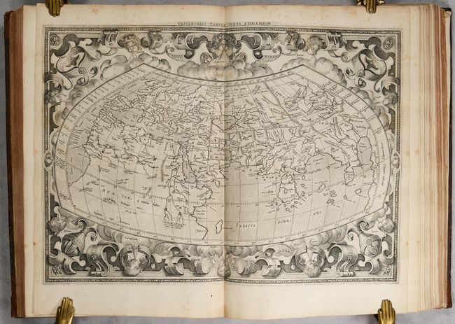
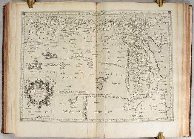
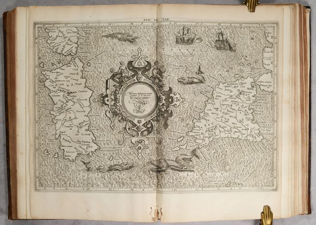
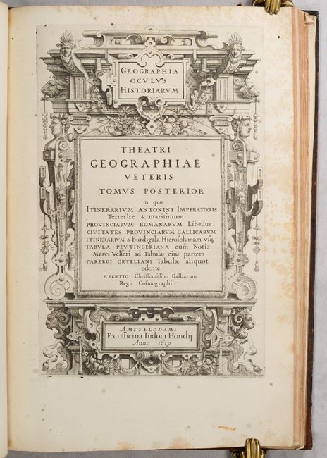
This is Petrus Bertius' superb historical atlas, which combines 27 Ptolemaic maps by Gerard Mercator, 14 maps from or based on Ortelius' Parergon, and Ortelius' Peutinger Table on 4 sheets plus one extra map related to the Peutinger Table. The maps are separated into two distinct sections, with separate title pages for each. The maps are accompanied by Ptolemy's text, edited by Petrus Bertius, and presented in side-by-side columns in Greek and Latin.
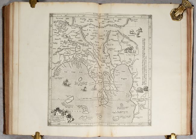
The Mercator maps include one of the ancient world, 10 of Europe, 4 of Africa, and 12 of Asia. Of particular interest is the map of the ancient world, which only appeared between 1578-1618 and is quite scarce. The strapwork border features 12 wind heads, which was re-engraved after 1618. This map served as an index sheet for the Ptolemaic maps with the number of maps in each section noted within each continent.
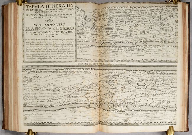
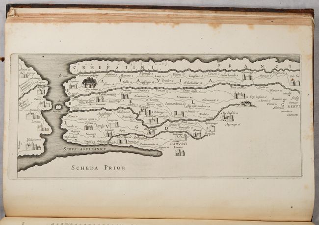
The section on the famous Peutinger Table features a lovely architectural frontispiece. Ortelius' scarce version of the Peutinger Table is printed in a sequence of four plates, each with two strip maps, depicting the imperial roads and posts within the Roman Empire throughout Europe, North Africa and Asia as far as Toprobana (Sri Lanka). The format distorts the landmasses, but provides an excellent view of the cities and roads, which include distances between the posts. The three most important cities of the Roman Empire, Rome, Constantinople and Antioch, are represented by enlarged symbols including the emperor seated on a throne. An additional map, Scheda Prior, has been included and gives a close-up view of the top left portion of the first segment in the Peutinger Table.
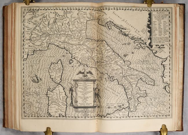
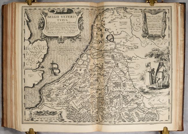
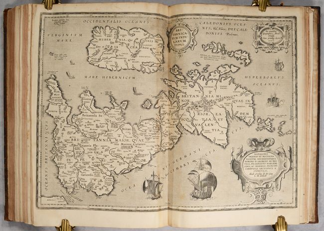
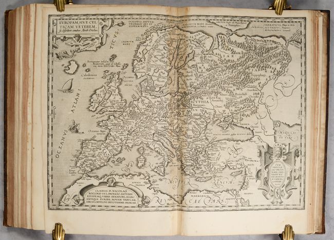
The final portion of the atlas features maps from Ortelius' Parergon. Bertius had purchased a number of sheets from 12 of Ortelius' maps of ancient geography, which he included in his Theatri Geographie Veteris with reset text on verso. The other two maps, Belgii Veteris Typus and Italia Antiqua, were not purchased from Ortelius, but were newly engraved by Pieter van den Keere and Jodocus Hondius and based on Ortelius' original maps of the regions. As Bertius ran out of the Ortelius sheets, he replaced the maps with new ones engraved by Van den Keere and Hondius. This early example includes only the two original maps by Van den Keere and Hondius, however later editions of this atlas have up to 9 replacement maps.
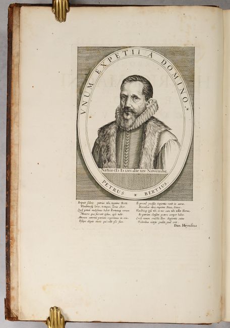
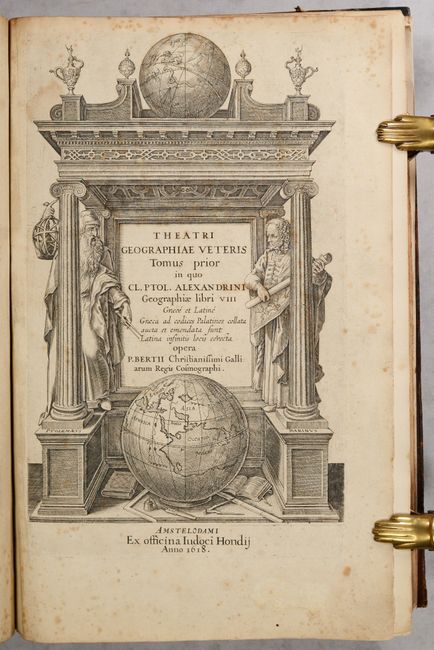
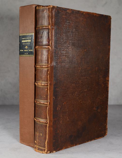
Large folio with text, two engraved title pages, engraved portraits of Bertius and Mercator, 7 smaller engravings within text, and 45 double-page maps and 1 single-page map. Pages 49-50 and 59-60 from Ptolemy's text appear to be missing, and have been replaced with blank sheets. Hardbound in 18th century binding with full brown leather; raised bands, gilt tooling and red leather title label on spine. Housed in modern brown buckram slipcase with black leather title label on spine.
References: Shirley (BL Atlases) T.PTOL-11h; Van der Krogt (Vol. I) #1:512, pp. 486-91.
Condition: B+
Overall this atlas is in very nice condition. The maps have mostly dark impressions, with light to moderate printer's ink residue, occasional offsetting, and light foxing that is mostly confined to the blank margins. The first 11 Mercator maps have small worm tracks confined to the bottom margin. The 4 Peutinger map sheets were trimmed at the top by the bookbinder with loss of the titles printed above each top segment. The Ortelius maps have light toning along the centerfolds, and 4 of the maps have light dampstains in the bottom corners. The map of Europe has a small hole at left. The text has light, scattered foxing and minor soiling. There are archival repairs to several leafs, primarily to reattach leafs that had become loose, including the first title page. The front and back hinges have been reinforced. The covers and spine are well worn with bumped corners, abrasions, and some cracking along the spine. Binding tape has been used to help secure the spine to the front cover, however the binding tape is beginning to lift along the spine side. The slipcase has light wear.