Subject: Cartographic Miscellany, Puzzle Maps
Period: 1850 (circa)
Publication:
Color: Hand Color
Size:
9.8 x 8 inches
24.9 x 20.3 cm
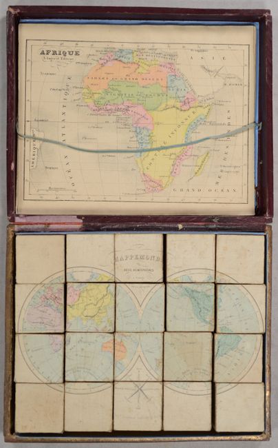
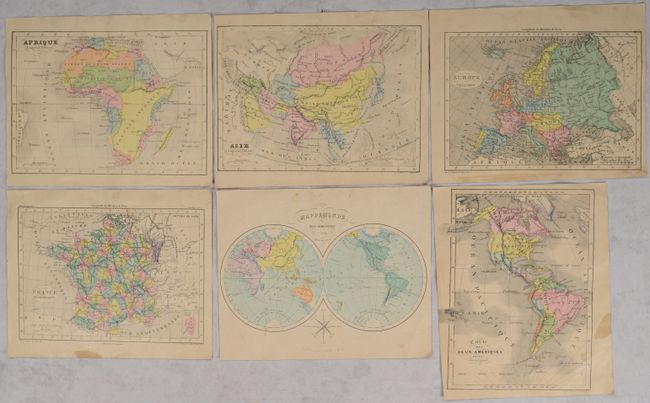
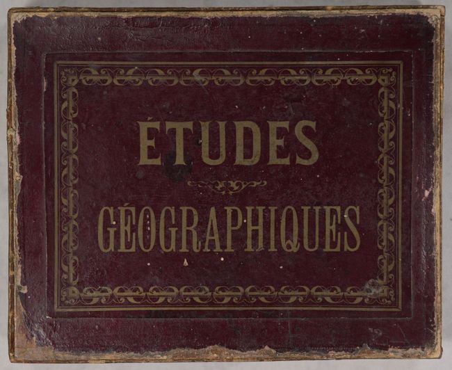
This extraordinary and complete puzzle consisting of six maps - World, Western Hemisphere, Europe, Asia, Africa and France - are on the face of 20 wooden cubes. Getting the puzzles in the correct order is not easy and reminds one of working with a Rubik's Cube. The cubes neatly fit into the original wooden box that has maroon paper on the sides and top with embossed gilt titling on top. The six guide maps lay in the top of the box, held in place with a woven blue string. The cubes make the following maps.
A. Mappemonde en Deux Hemispheres a l'Usage de la Jeunesse (8.6 x 6").
B. Carte des Deux Ameriques (6.4 x 8.5").
C. Afrique (8.5 x 6").
D. Asie (8.5 x 6").
E. Europe (8.2 x 5.7").
F. France par Departements (8.0 x 5.6").
Each guide map is present to aid in the organization of the cubes into a finished map. Later editions of this puzzle were produced with 30-35 pieces. An early cartographic curiosity that has survived well given its purpose as a game.
References:
Condition: B
The puzzle pieces are good with some soiling, light wear from use, and occasional minute loss along the cube edges. The guide maps have uniform light toning and minor stains in the blank margins. The entire box is present but the bottom is no longer attached. The decorative box top is moderately worn with loss along the edges.