Subject: India & Sri Lanka
Period: 1930 (circa)
Publication:
Color: Printed Color
Size:
28.7 x 37.3 inches
72.9 x 94.7 cm
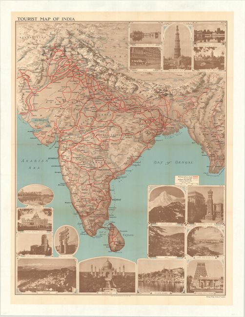
This large, boldly designed map of India also includes Pakistan, Nepal, Bhutan, Bangladesh, and parts of Afghanistan, Tibet, and Myanmar. It is surrounded by large sepia-toned images of notable sights and destinations, such as the Taj Mahal, Qutb Minar, Jaipur, Bombay (Mumbai), Darjeeling, the Victoria Memorial in Calcutta, various temples, and more. The map is veined with red lines indicating the railways (both broad and narrow gauge), and political boundaries are delineated by dotted line. Published by George Philip & Son in London. This example is mounted on linen.
References:
Condition: B+
Issued folding, now flat and mounted on linen. There are a few short archivally repaired fold separations and minor toning along the folds.