Subject: Asia
Period: 1787 (circa)
Publication: Nieuwe Natuur-Geschieden Handelkundige Zak-En Reis-Atlas
Color: Hand Color
Size:
9.4 x 6.9 inches
23.9 x 17.5 cm
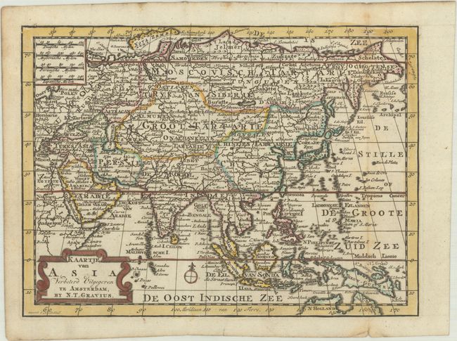
This small Dutch map of Asia is filled with information and is an updated edition first engraved by Jacob Keizer circa 1747. Most notably there are improvements to the depiction of Kamchatka and Japan. At bottom right, the coastline of New Guinea has been completed, and the northern coastline of Australia has been extended based on the explorations of Captain Cook. In the upper border, the shape of Nova Zembla has been updated and is no longer attached to the mainland. The Sea of Japan is named the Corease Zee. This map appeared in Gerrit Brender a Brandis' Nieuwe Natuur-Geschieden Handelkundige Zak-En Reis-Atlas, which was published by Nicholaes Theodorus Gravius. The atlas included many maps engraved by Jacob Keizer and published in pocket atlases by Jan de Lat, some of which were updated with new geographical information and with Gravius' imprint replacing that of Keizer and De Lat.
References:
Condition: B+
A crisp impression with contemporary outline color, issued folding on a bright sheet with a Strasbourg lily watermark. There is a tiny fold separation at bottom right and light foxing along the right-hand fold.