Subject: Northern England
Period: 1713 (circa)
Publication: The Theatre of the Empire of Great Britaine...
Color: Hand Color
Size:
20.4 x 15.5 inches
51.8 x 39.4 cm
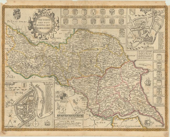
This stunning and uncommon map of North and East Yorkshire is divided into wapontakes and locates towns, cities, rivers, forests, hills, and parks. Ships and sea monsters appear in the seas. The Humber River is prominently depicted. Detailed inset plans of Richmond and Hull fill the top right and bottom left corners, respectively. The coats of arms of noble families of Richmond and Holdernes are featured at top and right. An ornate title cartouche and the coats of arms of the Union of Crowns decorate the top left corner. Two putti with a giant compass and another coat of arms sit atop the scale of miles. Engraved by Jodocus Hondius. Blank verso. Published by Henry Overton, who bought Speed's plates from Christopher Browne circa 1713.
References: Shirley (BL Atlases) T.SPE-1l.
Condition: B+
Light scattered foxing. There are two chips in the top blank margin and two small stains in the bottom blank margin from a previous framing.