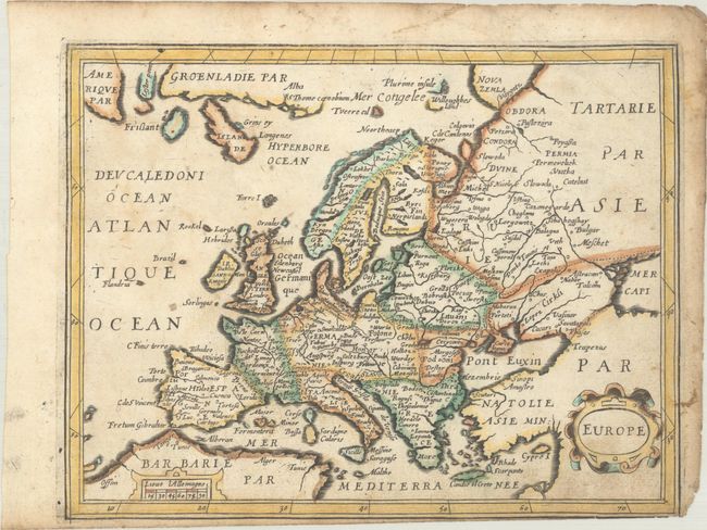
Subject: Europe
Period: 1655 (circa)
Publication: Carte Generalle de la Geographie Royalle
Color: Hand Color
Size:
7.8 x 6 inches
19.8 x 15.2 cm
This uncommon small map of the continent includes the mythical island of Frislant to the west of Iceland. It also depicts the small, apocryphal island of Brazil in the Atlantic. The tiny island of Rookol (Rockall) is located as well. Nova Zemla is a vaguely defined stretch of coast in the north, with nearby coastlines labeled Plurime Insule and Willoughbes Land. The latter refers to Hugh Willoughby, an English explorer who searched for a Northeast passage to the East Indies in 1553. The map names several towns and cities and delineates rivers. There is a strapwork title cartouche at bottom right and a small distance scale cartouche at bottom left. According to Pastoureau, the map was likely engraved by H. Picart. Published by Nicolas Berey.
References: Pastoureau, TASSIN I A [2].
Condition: B
On paper with a bunch of grapes watermark. There is light soiling, minor offsetting, and a printer's crease at top right. The margin is trimmed at bottom right, with a small portion of the neatline missing.