Subject: Atlantic Ocean & South America
Period: 1780 (circa)
Publication:
Color: Black & White
Size:
18.3 x 12.8 inches
46.5 x 32.5 cm
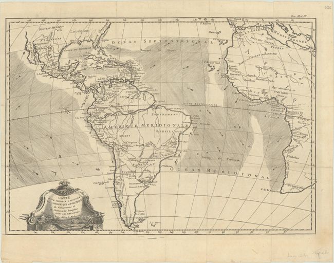
This chart is roughly centered on the Atlantic Ocean and includes most of Africa, the southern part of North America, the West Indies and all of South America. The focus of the chart is European trade and commerce with the Americas. Arrows depict the directions of the currents or prevailing winds in the oceans. There is a fair amount of detail in Central and South America. Two mythical lakes, L. Parim and L. Xarayes, appear in South America. The Baja is here called Californie, and only the cities of New Orleans, Santa Fe and St. Augustine appear in the U.S. Embellished with a decorative title cartouche.
References:
Condition: A
A nice impression, issued folding on a sheet with a bunch of grapes watermark and a few faint spots of foxing in the title cartouche. There are some short tears and creases along the edges of the sheet, well away from the image. The left margin is a bit narrow but still ample for framing.